
On this page
- Message from the Surveyor General
- Surveyor General Branch – Who we are
- Our programs
- Government-wide priorities
- NRCan priorities
- The SGB priorities and achievements
- Responding to current and future challenges
- Acronyms
- Annex 1: Contact us
- Annex 2: Program metrics
- Annex 3: Publications
- Annex 4: Awards
- Annex 5: Human Resources Data
Message from the Surveyor General
As the newly appointed Director General, Surveyor General and Canadian Commissioner to the International Boundary Commission, I am honoured to present the Surveyor General Branch (SGB) Biennial Report for 2024–2026. This report highlights our key achievements, strategic priorities, and significant publications from the past two years and will be the last one reporting on the SGB Integrated Business Plan (IBP) 2023–2026. The SGB is currently developing a new IBP for the branch, which will define our new strategic priorities for the next three years.
Our priorities align with the priorities of the Government of Canada that are designed to grow the economy and stimulate innovation. Our programs fall into Natural Resources Canada’s (NRCan) first core responsibility: Natural Resource Science and Risk Mitigation. Our work influences government policy and priorities and our programs continue to generate new information and ideas about Canada’s lands and land management tools and practices.
This year’s biennial report highlights the achievements made in our three current strategic priorities, namely:
- Indigenous Peoples’ control of their lands and supporting Northern property rights
- Canadians access world-class positioning for safety, security, and economic prosperity
- Protection of Canada’s Oceans
The report will outline the ways in which the SGB supports and advances emerging government-wide priorities through its programs, services, and collaborative initiatives. In addition to these priorities, the report will also highlight how the SGB contributes to the Department’s key priorities.
This report explains how the SGB is carrying out its work in a changing environment. Each year, we face challenges that we must manage to keep delivering our programs and to make sure Canadians have access to secure and reliable land survey system and clearly defined boundaries, as well as accurate positioning, navigation, and gravity information. These challenges include new laws and regulations, impacts from developments in the United States, climate change, fast-moving technologies like artificial intelligence, while keeping a fiscally responsible approach. Thanks to the hard work and dedication of all our employees, we have been able to overcome the many challenges throughout 2024 to 2026 and have been experiencing great success in all our projects.
I hope you will appreciate the hard work that has gone into this biennial report.
Thank you for your unwavering enthusiasm and commitment to the SGB.

Martin Gingras
Surveyor General for Canada Lands
Canadian Commissioner, International Boundary Commission
Director General, Surveyor General Branch, Lands and Minerals Sector, Natural Resources Canada
Surveyor General Branch – Who we are
The SGB continues to ensure that Canadians have access to secure and reliable land survey system, clearly defined boundaries, and accurate positioning information to meet Canada’s economic, social, and environmental needs.
In 2024 to 2026, we had:
- An annual budget of $24M in 2024–2025 and $23M in 2025–2026.
- 161 employees, including professional surveyors, Canada Lands surveyors, geodetic engineers, research scientists, IT specialists, policy analysts, technologists, and administrative support staff.
- Ten regional offices (RO) across Canada with headquarters in the National Capital Region (see Annex 1. Contact us!).
- A dynamic workforce comprised of full-time and part-time staff, students, and seasonal staff.
Our programs
The SGB continues to focus on three key programs that align with several government priorities and commitments. Our work contributes to NRCan’s Core Responsibilities related to Natural Resource Science and Risk Mitigation by providing important information about Canada’s lands and supporting vital land management tools and practices.
- The Canada Lands Survey System (CLSS) helps to define, demarcate, and describe property boundaries and the extent of property rights for Canada Lands—the North, First Nations reserve lands, national parks, and offshore. With boundary certainty and a well-maintained property rights system, stakeholders can focus on community well-being and economic growth. A strong land survey system is especially significant to support Indigenous self-governance.
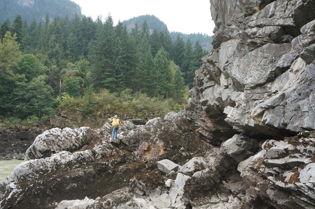
A surveyor working among exposed rock formations and forested terrain.

A coastal northern landscape featuring a fixed geodetic or navigational marker representative of CGS infrastructure used to support precise positioning.
- Canadian Geodetic Survey (CGS), in collaboration with intergovernmental and international partners, maintains the Canadian Spatial Reference System (CSRS), maintaining and providing access to the foundational standards defining latitude, longitude, elevation, and gravity in Canada. It also monitors motion of our continental land mass in support of geomatics and geoscience. These measurements are necessary for anything for which precise and timely geolocation matters, enabling mapping, surveying, construction and engineering, land and water management, precise positioning and automation, and environmental and natural hazards monitoring across Canada.
- The Canadian Section of the International Boundary Commission (IBC) in cooperation with its U.S. counterpart, preserves and maintains a clear and visible boundary between Canada and the United States. This work includes maintaining the boundary monuments and open vistas through forested areas, as well as authorizing the construction of works within 3 metres of the 8,891-kilometre boundary. Having a clearly visible Canada-United States boundary is essential to the safety of citizens who carry out activities near the border and to law enforcement agencies for protecting the security of Canadians and preserving our sovereignty.
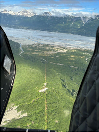
Helicopter view of the international boundary vista along the Alsek River Valley, British Columbia/Alaska.
Government-wide priorities
The Government of Canada has outlined clear priorities for the coming years, including advancing reconciliation with Indigenous Peoples, strengthening sovereignty and security, supporting major infrastructure development, and improving the efficiency of government operations. These national priorities guide our work as they contribute to Canada’s long-term prosperity and stability.
The SGB plays a central role in this effort by providing the land, boundary, and geospatial services that support many government commitments. The SGB contributes to reconciliation by helping promote a modern First Nations–governed land registry and by maintaining a reliable land survey system that supports Indigenous self-determination and community development. The SGB also works with provinces and industry to modernize Canada’s positioning and measurement systems, improving efficiency and reducing risks for major infrastructure projects.
By delivering authoritative land and geospatial information, the SGB helps reduce duplication, improve data accuracy and interoperability, and support cost-effective operations across federal departments—contributing to economic growth, national security, and long-term national resilience.
NRCan priorities
To support NRCan’s Core Responsibility for Natural Resourc e Science and Risk Mitigation, the SGB delivered the following key program activities from 2024 to 2026. For more information, please consult NRCan’s Departmental Plan.
This section highlights the SGB’s contribution to the Department’s results over the last two fiscal years. As part of NRCan’s Core Responsibility for Science and Risk Mitigation, CGS, the CLSS, and the IBC help drive fundamental science forward and share their expertise to ensure that Canadians have access to cutting-edge research to inform decisions on natural resource management.
Canadian Geodetic Survey
CGS provides the foundational spatial reference needed for all applications that require precise positioning, including boundary determination, accurate water level determination, precision agriculture, construction, mining, and navigation.
In 2021, CGS received $5.6 million over five years to expand Canada’s Global Navigation Satellite System (GNSS) ground segment to increase the accuracy and availability of real-time position, navigation, and timing information across Canada. NRCan’s satellite stations track and receive data for mapping, land and atmospheric monitoring, surveying and construction, and more.
Between 2024 and 2026, CGS achieved major milestones towards modernizing Canada’s national spatial reference system, including the redefinition of parameters defining latitude, longitude, and elevation (aka mean sea level). Planned for adoption in early 2027 in coordination with the United States, this modernization will ensure consistency and compatibility of geodetic reference systems across North America. CGS also made significant advances in its GNSS and gravity products and services, responding to the increasing accuracy, reliability, and availability needs of its clients across government operations, industry, and the geosciences.
Canada Lands Survey System
The Department announced its continued commitment to advancing reconciliation in partnership with Indigenous peoples, including through the ongoing work of the SGB.
In collaboration with Indigenous Services Canada (ISC) and Crown-Indigenous Relations and Northern Affairs Canada (CIRNAC), the SGB advanced First Nation self-determination and economic reconciliation within the First Nations Land Management (FNLM) program. This included expanding this successful program and supporting the establishment of a First Nation Land Governance Registry (FNLGR), along with a new organization dedicated to its management.
In 2024, the SGB focused on exploring effective approaches to engage stakeholders and First Nations to gather meaningful input in support of modernizing the Canada Lands Surveys Act. During this period, efforts also continued to finalize the modernization of the Canada Lands Survey System (CLSS) and to support the continued growth of FNLM and the establishment of the FNLGR and its managing organization.
The Gwich’in Comprehensive Land Claim Agreement, a five-year land survey program in the Northwest Territories, entered its fifth year in 2025. The SGB worked with the Gwich’in Department of Lands and the Gwich’in Tribal Council to implement Canada’s obligations under the treaty to complete surveys and demarcate Gwich’in lands. The Branch also supported work on upcoming Comprehensive Land Claim Agreements (CLCA) by developing land survey programs as necessary.
Canada-U.S. International Boundary Treaty
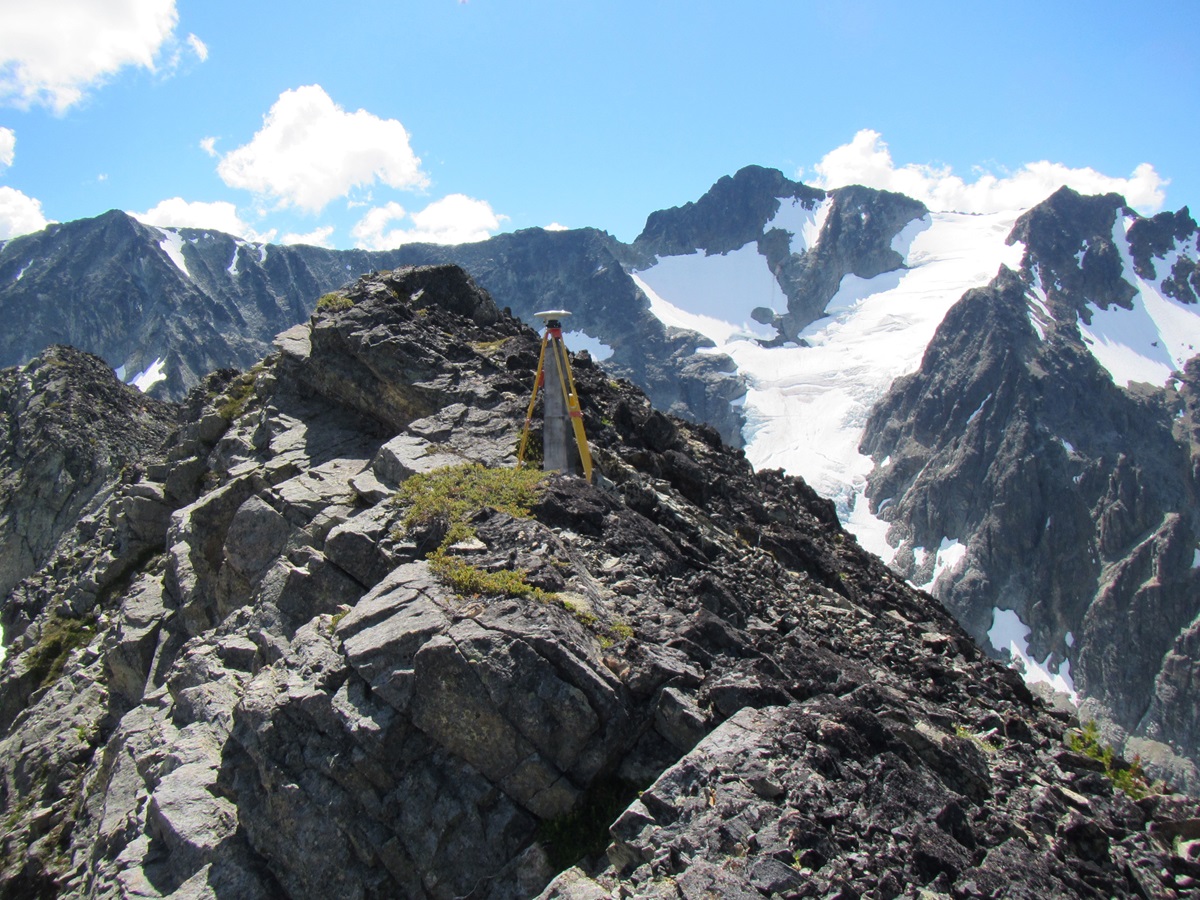
A mountainous boundary landscape illustrating IBC field operations, with a survey marker and tripod positioned on exposed alpine rock.
The Canadian Section of the IBC, working collaboratively with its U.S. counterpart, ensures that the Canada–United States boundary remains clearly defined, well maintained, and fully visible. A stable and accurately demarcated boundary supports effective land administration and cross-border coordination, creating the foundation for sound decision-making in areas such as natural resource management and national security.
In 2024–2025, the Canadian section delivered the yearly projects identified by the Commissioner in accordance with the 15-year maintenance plan. These projects included field surveys, maintenance, and vista clearing, as well as inspections along various sections of the international boundary, from British Columbia to New Brunswick.
In 2025–2026, this work continued, with ongoing efforts to preserve boundary visibility and integrity through regular inspections, maintenance activities, and binational collaboration. A clear and visible border primarily safeguards Canada’s sovereign rights and supports the protection of the public, while also enabling law enforcement agencies and other partners to access reliable boundary information necessary for informed decision-making.
The SGB priorities and achievements
Indigenous Peoples’ control of their lands and supporting Northern property rights
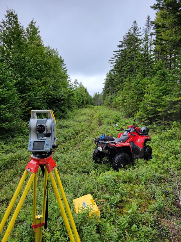
Surveying in a remote area along the international boundary displaying surveying equipment and an all-terrain vehicle.
The SGB continues to advance reconciliation and support Indigenous self-determination by supporting Indigenous communities to exercise greater control over their lands. This priority focuses on providing technical expertise, legal frameworks, and collaborative approaches that respect Indigenous rights and governance systems.
In parallel, the SGB plays a critical role in managing Northern lands, ensuring sustainable development, environmental stewardship, and the protection of cultural and ecological values. Through these efforts, the SGB fosters partnerships that uphold Canada’s commitments to reconciliation and responsible land management in the North.
Our efforts continue to include more time for conversations with communities about their history and traditional land management practices to create a stronger relationship through the sharing of knowledge in a forum of mutual respect.
The Free Trade and Labour Mobility in Canada Act
The Free Trade and Labour Mobility in Canada Act and Regulations came into force on January 1, 2026. It promotes free trade and labour mobility by removing federal barriers to the movement of goods, services, and workers within Canada. The framework will remove federal barriers to interprovincial trade through the recognition of comparable provincial or territorial requirements. The intent is to allow qualified professionals to move between jurisdictions with minimal administrative burden.
As of March 31, 2026, we have seen remarkable uptake: 119 provincial land surveyors have chosen to become Canada Lands Surveyors. This represents roughly a 50 percent increase in ACLS membership and it’s a clear signal of the interest in working within the federal jurisdiction.
For the communities and partners who rely on the Canada Lands Survey System, this means a broader, more responsive service offering and better access to timely surveying expertise that supports land management, economic development, and infrastructure planning.
To support this influx of new professionals, the SGB is working closely with ACLS to design targeted onboarding and ensure these surveyors are ready to deliver high-quality work from day one. We remain committed to strong professional standards while enabling greater labour mobility, and it’s encouraging to see the legislation translating so quickly into real operational capacity across Canada Lands.
In addition to providing support during implementation, the new legislation will also require future amendments to the Canada Lands Surveyors Act. These updates will help ensure that the legislative framework remains aligned with evolving policy directions, reflects modern regulatory practices, and continues to support the effective delivery of survey related services on Canada Lands.
Modernization of the Canada Lands Surveys Act and Indigenous engagement
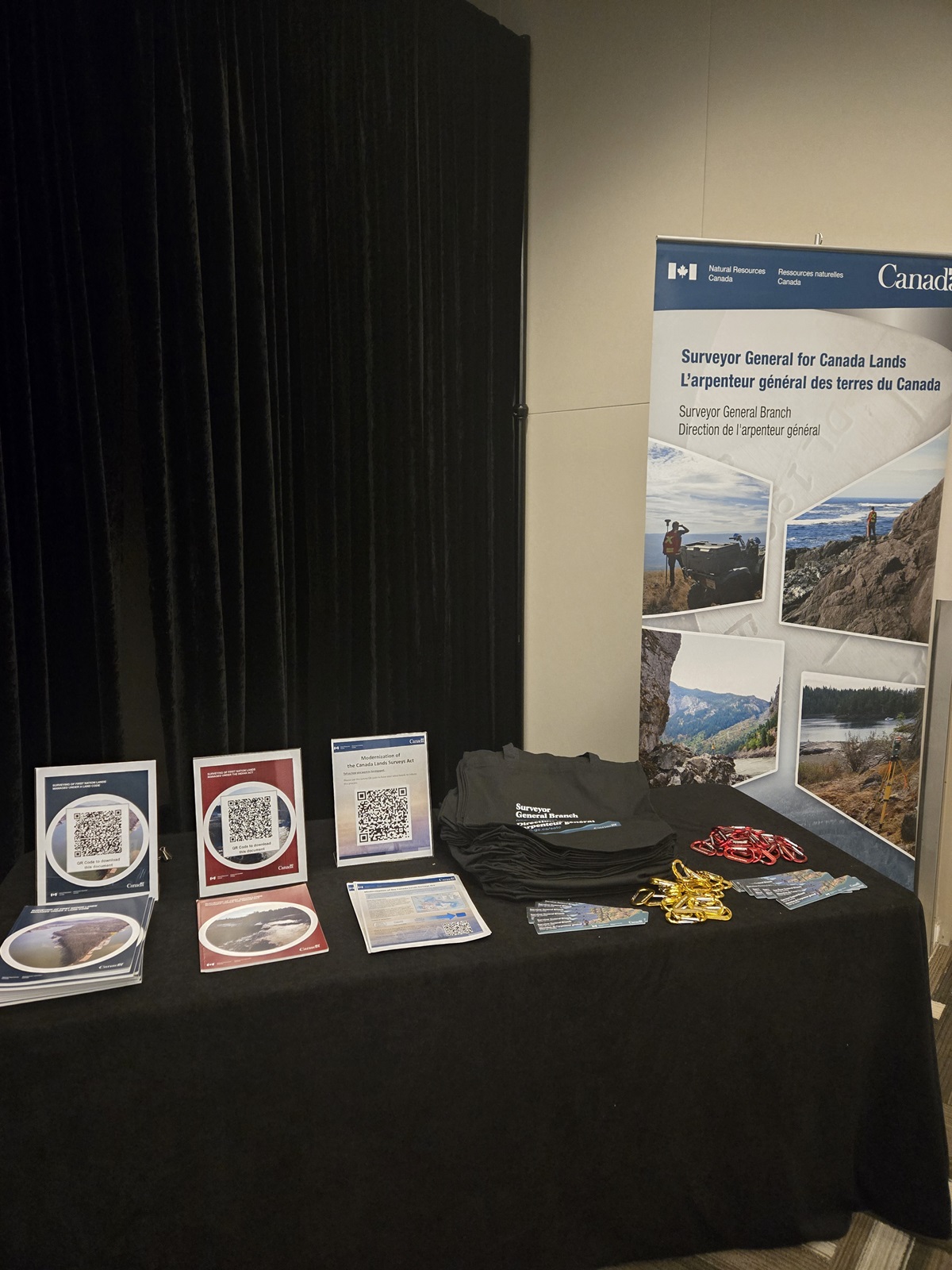
Display from the First Nation Land Governance Registry Session at Grey Eagle on Tsuut’ina Nation (Calgary) held on February 5–6, 2025.
The Canada Lands Surveys Act provides the policy framework for regulating land surveying on Canada Lands. Currently, the SGB is leading Indigenous engagement to modernize the Canada Lands Surveys Act and recognize advancements in the governance of Indigenous lands. The inherent right of Indigenous Peoples to self-determination, the United Nations Declaration on the Rights of Indigenous Peoples Act (UNDRIP), and other federal Indigenous reconciliation principles need to be recognized and supported by the Canada Lands Surveys Act.
The SGB completed the first phase of engagement focusing on identifying meaningful methods for engaging with Indigenous Peoples in modernizing the Canada Lands Surveys Act. The SGB established an internal working group, sought guidance from Elders on this initiative, participated in Indigenous-led events, and used online tools to communicate with communities. Preliminary results showed that the preferred methods include Indigenous-led in-person events, virtual sessions, and other means of communications (email, phone, mail). Over the coming months, these engagement strategies will be refined and applied as we move to the next phase of modernizing the Canada Lands Surveys Act.
Funding for the implementation of treaty obligations to survey land claims
Canada, as mentioned in the Comprehensive Land Claim Agreements (CLCA), is obligated to define the extent of land negotiated within comprehensive land claims. Natural Resources Canada ensures that Canada meets these obligations by having surveys required for these claims carried out as per the Canada Lands Surveys Act. For First Nations that have completed or are in the final stages of negotiations of the CLCA, it is particularly important that the Government of Canada completes the necessary survey work to support their capacity for self-government and to recognize the nation-to-nation relationship. Development cannot occur on land until the full extent of the lands is known. Surveying provides a clear indication of the extent of the land being governed. In this context, the SGB continues to work on the Gwich’in land survey program and is scheduled to start working on newly signed agreements shortly.
First Nations Land Management (FNLM)
Research and Land Description reports
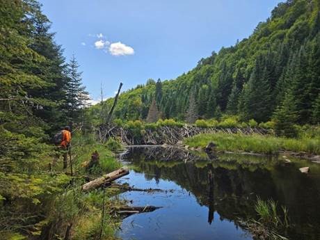
A surveyor working in an area that reflects lands that Indigenous Peoples have lived on, cared for, and stewarded for generations.
The SGB supports Canada’s implementation of the Framework Agreement on FNLM by providing detailed research reports on the history of reserve lands. It collaborates with ISC, the First Nations Land Management Resource Centre, and First Nations to resolve legacy land issues and prepares Land Descriptions to clearly define parcels and boundaries of reserves, as well as helping provide certainty over the extent of the lands to be administered under a First Nation’s land code laws. Since the beginning of Fiscal Year (FY) 2024–2025, a total of 78 Land Descriptions have been recorded in the Canada Lands Surveys Records (CLSR), while an additional 28 Land Descriptions have been finalized and are awaiting approval to be recorded in the CLSR. A total of 42 research reports have also been prepared and distributed to ISC and to the First Nations, identifying any survey issues that may need to be resolved prior to the Land Description being completed. Currently, 124 First Nations are under a land code and four are self-governing, while there have been a total of 219 signatories to the FNLM program.
First Nation Land Governance Registry (FNLGR)
Since Budget 2023 was announced, the SGB, in cooperation with CIRNAC, have been working with the Lands Advisory Board (LAB), the First Nations Land Management Resource Centre, and their partners to support the co-development of an FNLGR. To address design and operational requirements of the FNLGR, the SGB has adapted the Canada Lands Survey system by updating IT systems, internal processes, survey standards, and corresponding land surveying products. Since the project started, the SGB carried out preliminary research on 58 First Nations communities. In collaboration with the FNLGR team, the SGB also engaged with 6 pilot First Nations and prepared the corresponding multiphase reports for each land interest research study. Through the research, the SGB team developed a methodology and process to help identify, inform, mitigate, and solve problematic land interests.
The Land and Survey Knowledge-Sharing Program
The SGB supports the implementation of the Framework Agreement on FNLM by providing in-community knowledge-sharing to Indigenous communities for land surveying and related land management activities. This collaboration removes barriers to the community’s ability to regain management authority over their lands. The former capacity-building program that provided up to 12 weeks of hands-on in-community training to Indigenous participants needed to be revisited. Building on the lessons learned and the feedback received from participating First Nations over the years, the SGB proposes to continue this mission with a renewed delivery model that provides more flexibility in training options for Indigenous communities tailored to their needs and available when they need it. Over the past two years, we have undertaken a series of consultations with the First Nations Land Management Resource Centre and First Nations to develop a program tailored to their needs, based on their areas of interest and on whether they are in the development or operational phase of their land code.
The SGB’s Guiding Document – Walking the Land Together: Principles for Respectful Indigenous Engagement
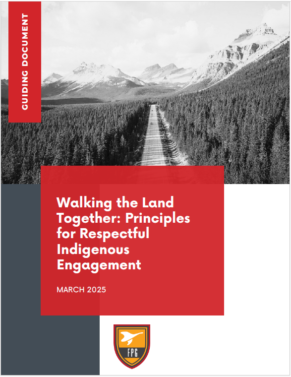
Cover of the Guiding Document: Walking the Land Together: Principles for Respectful Indigenous Engagement.
Over the past year, the SGB has collaborated closely with an Indigenous consulting firm to develop a guiding document titled Walking the Land Together: Principles for Respectful Indigenous Engagement.This document is grounded in open dialogue and the insights of the SGB staff, combined with the vision, wisdom, and extensive experience of the consultant. It serves as an internal resource to strengthen awareness and provide practical guidance for engaging respectfully with Indigenous Peoples.
The ever-evolving document was shared with staff in September 2025. Building on that momentum, we are currently working on additions that will include guidance for preparing written correspondence, additional examples and explanations, links to further reading on historical events, and suggested protocols for attending meetings—both in person and virtually—with Indigenous Peoples.
Given that over 80% of the SGB’s activities and programs involve Indigenous Peoples and their lands, it is essential that employees have access to resources that support the development of long-lasting relationships built on mutual respect and reciprocity.
Fifty years of the James Bay and Northern Quebec Agreement
The year 2025 marked the 50th anniversary of the James Bay and Northern Quebec Agreement, signed on November 11, 1975. As the first modern treaty to officially recognize Indigenous land claims in Canada, it resulted from an agreement between the Cree and Inuit nations, Quebec, Hydro-Québec, and Canada. Since the inception of the Agreement, the SGB has played a vital role in describing and surveying lands; particularly Category IA lands under federal jurisdiction. Even today, the SGB remains a key player by providing professional advice, mapping, and surveying services that support the management and development of Cree lands. The SGB participates in negotiation roundtables and contributes to maintaining the integrity of the Cree-Naskapi Land Registry, producing and updating official plans, conducting territorial negotiations, training local registrars, and performing various fieldwork and boundary inspections.
Between 2024 and 2026, the Quebec regional office (QRO) produced more than 100 registration plans to support the registration of rights in the Cree-Naskapi Land Registry, in addition to training three new Cree local registrars. The QRO participated in several negotiations related to land management for the communities of Waswanipi, Waskaganish, Eastmain, and Nemaska.
Activities in the North (Yukon, Northwest Territories, and Nunavut)
The CLSS continues to find adaptive methods to ensure that each of the public land and mining registries in the Territories has effective, reliable, and timely survey products to support a variety of land transactions. It is necessary to carry out an ongoing review of the National Standards for the Survey of Canada Lands and to maintain active communication with our territorial land administration stakeholders to provide the reliability required for land transactions, while meeting public demand for easy and transparent access to legal boundary products and data.
The SGB provides advice and guidance to a variety of federal departments that are operating in the Territories. This includes projects ranging from economic development, mineral tenure, conservation and protection, reconciliation, land management, and land descriptions. CLCAs in the Territories continue to be negotiated. The SGB works with legal boundary documents and datasets for CLCA governments and beneficiaries as they work to maximize the benefits in their agreement. Land boundaries and documents are a cornerstone of economic and social developments for CLCA communities and citizens.
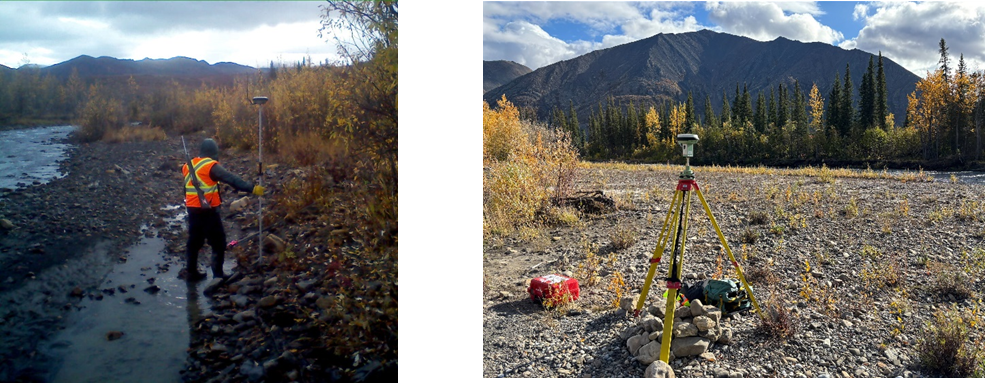
Field measuring equipment while working on a Comprehensive Land Claim Agreement in the NWT.
Canadians access world-class positioning for safety, security, and economic prosperity
CGS maintains the Canadian Spatial Reference System (CSRS), defining the standards for the measurement of latitude, longitude, elevation, and gravity anywhere in Canada. It also provides infrastructure, products, tools, and web services to access these measured values via modern technologies such as the Global Positioning System (GPS), for both expert and non-expert clients. The CSRS is a dynamic system, supplying precise, reliable positioning on a continuously changing planet, while keeping pace with the most advanced measurement techniques.
Raising awareness of the crucial importance of the Geodetic Supply Chain in Canada.
The Global Geodetic Supply Chain underpins all geolocated activities on earth and in space, including critical infrastructure and satellites. Many organizations, including the UN-Global Geodetic Centre of Excellence, have been raising awareness of how our modern society depends on an increasingly fragile geodetic supply chain. CGS has been actively engaging across the federal government and beyond to raise awareness of this global vulnerability and Canada’s role.
In 2025, the Defence Research and Development Canada Canadian Safety and Security Program and the Council of Canadian Academies (CCA) awarded NRCan funding for two studies which will identify gaps in the Geodetic Supply Chain and their impacts on positioning, navigation, and timing (PNT) activities, perform an environmental scan on international models for geodetic supply chain governance, and provide briefing materials for senior decision makers. These and other engagement activities will identify where Canada’s geodetic ecosystem can, and cannot, support the demands of today’s economy and current government priorities, and suggest pathways to address gaps.
Reference system modernization
For over one hundred years, Canada and the United States have collaborated to ensure consistent definitions of latitude, longitude, and elevation to ensure consistent measurements across borders and waterways. As technology advances and the landmass changes, reference systems and frames must evolve to meet current needs. A major binational reference system update is planned for early 2027, with new standards, products, and tools being developed in collaboration with provinces and partners in the United States. Having a decade or more of intense effort and collaboration, CGS, together with its partners, has achieved the following between 2024 and 2026:
- Developed a new continental-scale gravity-based model to define mean sea level for North America (Ahlgren et al., 2024).
- Recalculated the rotation of the North American Tectonic Plate, which will define the new North American Terrestrial Reference Frame of 2022 (NATRF2022) and replace the North American Datum of 1983 (NAD83) in both Canada and the United States (Goudarzi et al., 2025).
- Updated online and desktop tools released in beta mode for testing, accessible through a new CSRS Modernization web page.
- Engaged with provincial, public, academic, and industry partners through presentations and workshops, including with geospatial software developers and surveyors.
A significant step towards the transition to NATRF2022 was the release of NAD83(CSRS) v.8 in the fall of 2024.
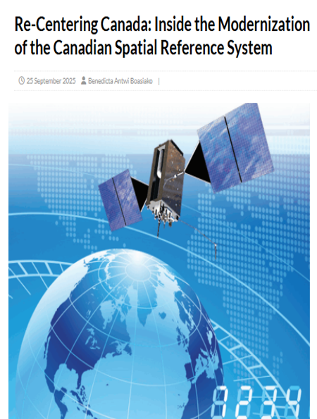
CSRS Modernization efforts were featured in the "Re-Centering Canada" in September 2025, one of a series of CSRS Modernization Articles.
Improving NRCan’s Precise Point Positioning service (CSRS-PPP)
CGS is continually improving its online positioning service known as CSRS-PPP. This service helps people who use GPS equipment (such as land surveyors, engineers, construction crews, and scientists) to obtain extremely accurate and authoritative positions, sometimes down to just a few millimetres. Because of its ease of use, CSRS-PPP makes precision available to everyone—including those with no technical background—to deliver advanced applications such as asset tracking, critical infrastructure monitoring, and emergency response.
In 2025, CGS added the EU’s Galileo satellites into the service. CSRS-PPP can now produce better results for data collected as far back as the 1990s. Enabled by international data-sharing and collaboration through the International GNSS Service (IGS), this update decreases Canada’s dependence on U.S. and Russian satellite systems and improves our ability to provide consistent and accurate positions on Earth. CSRS-PPP now provides clients the option to process:
- GPS (U.S. satellites) data back to 1995
- GLONASS (Russian satellites) data back to 2009
- Galileo (European satellites) data back to 2014
Recognized by GPSWorld as setting “a new standard for high-precision GNSS” and “contributing enormously to the democratization of centimetre-level GNSS positioning for users,” this update is another step towards keeping Canadians competitive in the digital and geospatial economies. In 2025, CGS shared this technology with Ukraine, providing a vital tool for precise PNT in areas where geodetic infrastructure has been disrupted—supporting the restoration of energy infrastructure, as well as recovery efforts in mining, agriculture, and other critical sectors.
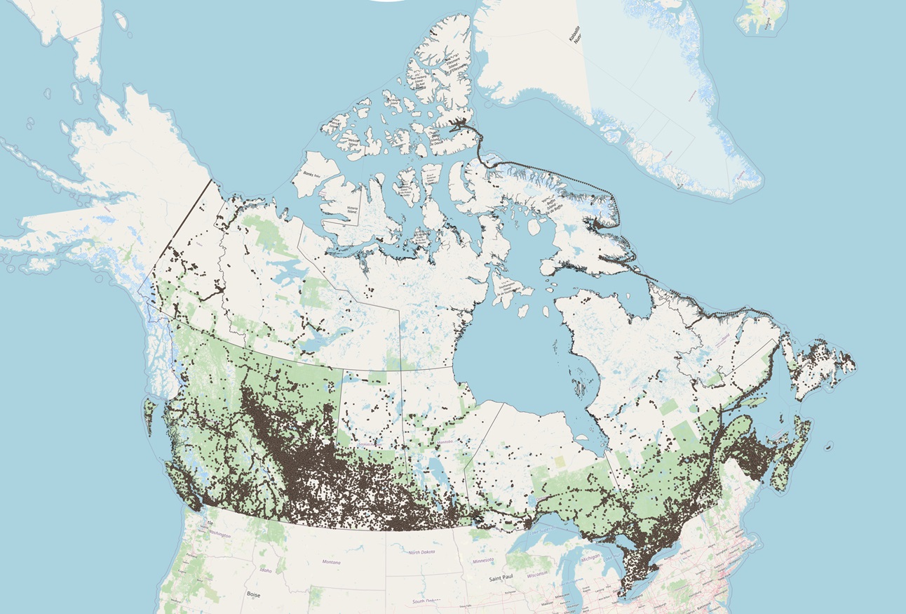
Description of figure
A map of Canada prepared by CGS showing the country’s landmass in a light color and surrounding water in blue. Numerous small brown dots represent the 358,646 files processed by NRCan’s Precise Point Positioning (PPP) web service in 2025, out of a total of 5.6 million files processed worldwide. The dots are heavily concentrated across southern Canada, especially along the border with the United States, with the highest density in southern Ontario, Quebec, and parts of British Columbia and Alberta. The number of dots decreases moving north, with very few points in northern regions and the Arctic.
Map showing the 358,646 files processed by NRCan’s PPP web service in 2025 (brown dots), out of a total of 5.6 million files processed worldwide.
Completing the expansion of Canada’s national GNSS ground segment
CGS completed the expansion of its GNSS ground segment, known as the Canadian Active Control Station (CACS) network. Funded in Budget 2021, the space-based earth observation (SBEO) project has doubled the CACS network, filling gaps in remote and Northern communities. Data from these stations is now coming online through CGS’s web service, providing Canadians important new entry points to the CSRS while also contributing to its improvement. This expansion will also provide significant advances in our understanding of earth, water, and atmospheric processes throughout Canada.
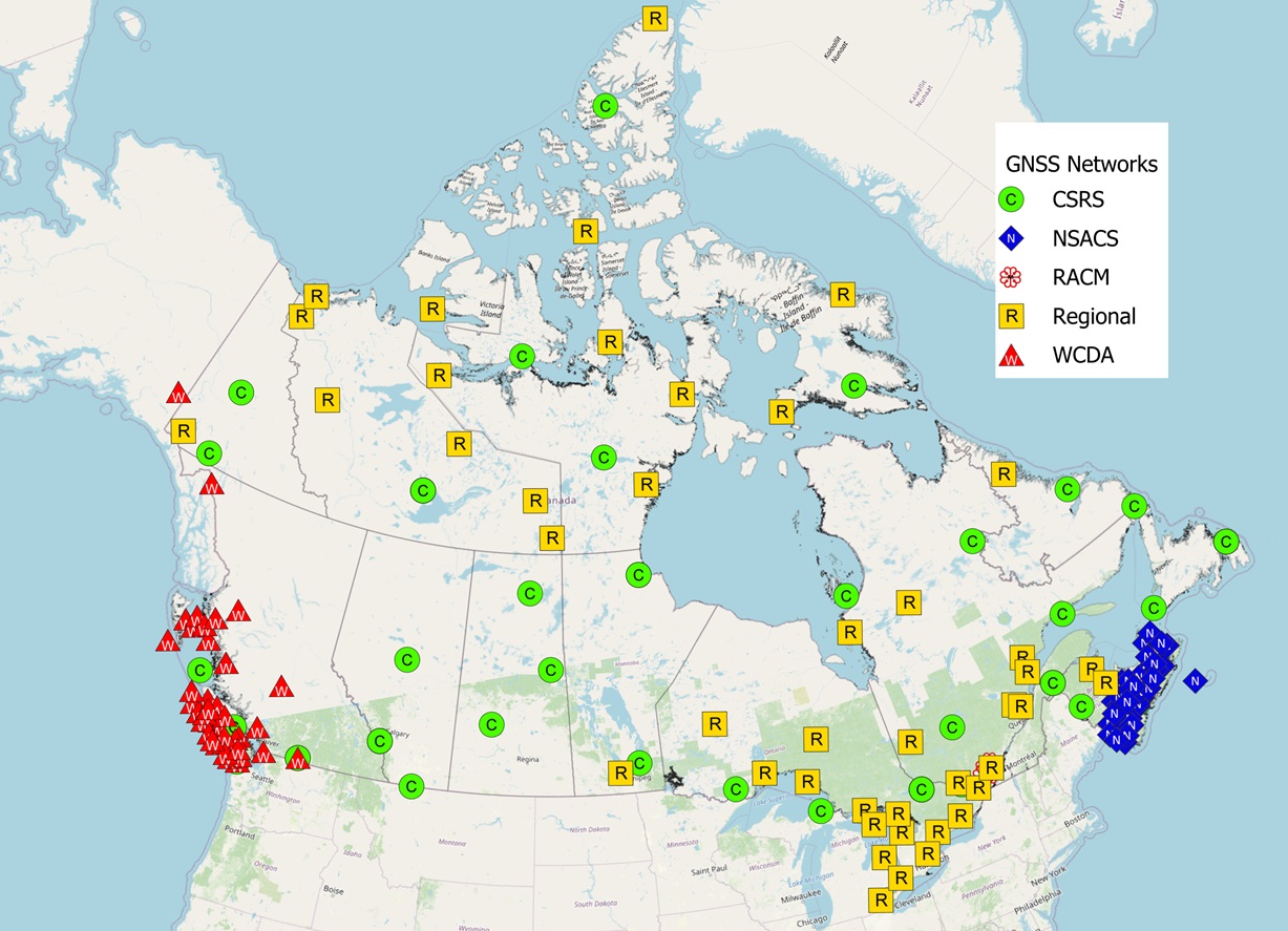
Description of figure
A map of Canada showing GNSS active control stations associated with CGS. Yellow squares and green circles represent stations operated by CGS, while red triangles and blue diamonds represent stations whose data are processed and distributed by CGS. The stations are most densely concentrated in southern Canada, particularly in British Columbia, southern Ontario and Quebec, and the Atlantic region, with fewer stations in northern areas.
Map showing the GNSS Active Control Stations operated by CGS (yellow and green) or stations whose data is processed and made available by CGS (red and blue).
Monitoring the motion of the Canadian landmass and environmental change
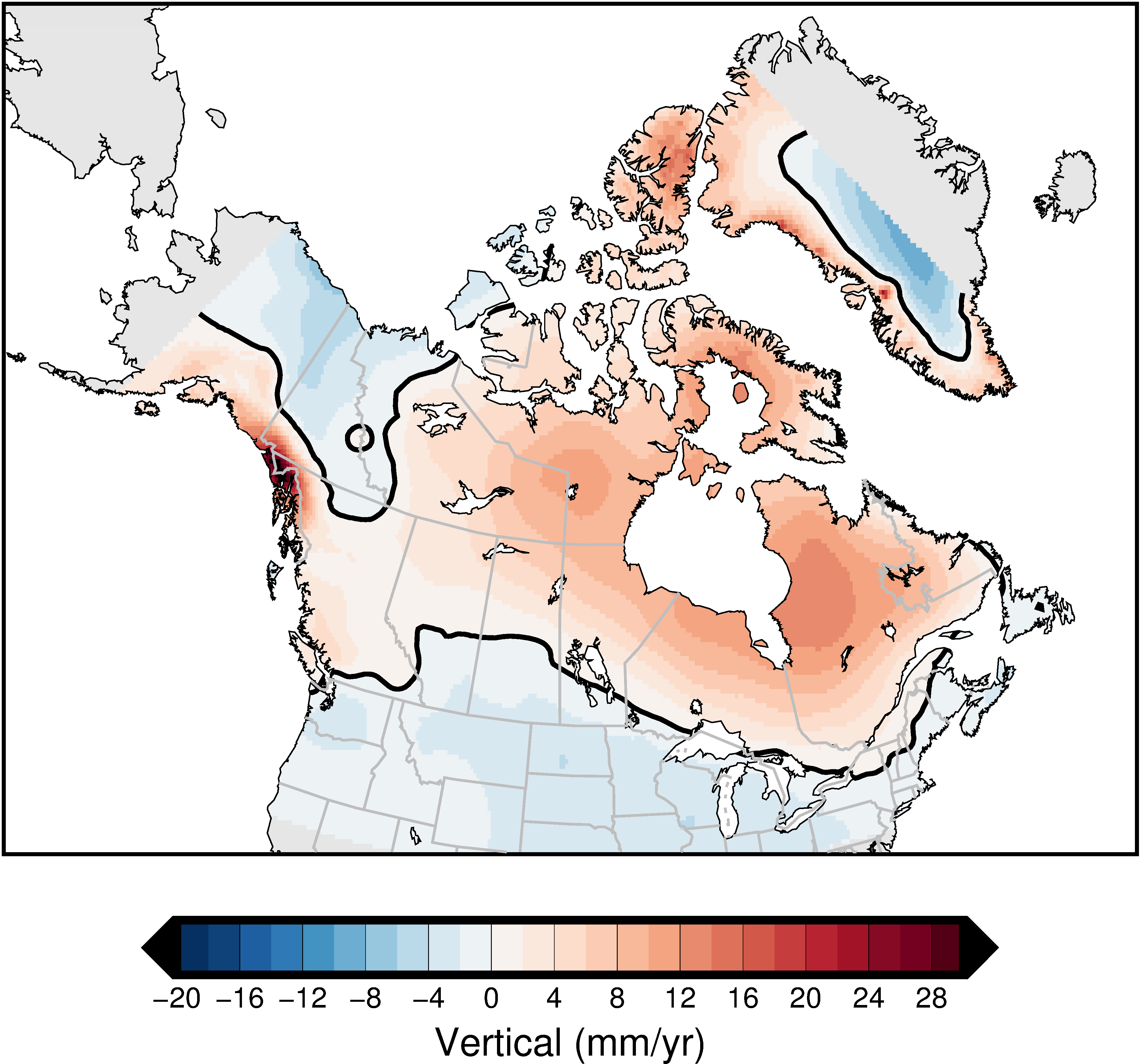
Description of figure
The new NAD83v80VG velocity model using an updated velocity field for Canada - ScienceDirect
Map of Canada showing the updated crustal motion model released as part of NAD83(CSRS) version 8. Vertical land motion is represented in millimetres per year using a diverging colour scale from blue (negative values, subsidence) to red (positive values, uplift). Central and eastern Canada are predominantly shown in light to moderate red tones, indicating uplift consistent with postglacial isostatic rebound. In contrast, parts of western Canada, Arctic regions, and coastal areas display blue tones indicating subsidence. A localized zone of high uplift is visible along the southwest coast of British Columbia, while a broad band of subsidence extends across portions of the Arctic and western Canada. Thick black lines delineate major tectonic or geophysical boundaries associated with the deformation field.
The new crustal motion for Canada released as part of the NAD83(CSRS) v.8 update in the fall of 2024. See Simon et al. for details.
Monitoring environmental change across multiple timescales is essential to maintaining the CSRS and providing high-quality geodetic information in Canada and internationally. The new national crustal motion model released with NAD83(CSRS) v.8 in late 2024 incorporates data from newly installed stations, expanded datasets from existing stations, a full reprocessing of historic GNSS measurements, updated geophysical models, and a detailed reanalysis of time-series discontinuities (Simon et al., 2025). These enhancements significantly improve our ability to map how positions evolve over time and deepen our understanding of the motion of Canada’s landmass. Notably, the model provides a clearer picture of the “hinge line”—the transition between land uplift and subsidence resulting from the melting of continental ice sheets. Accurately mapping this line, which is parallel to and runs through the Great Lakes, is critical for accurate flood mapping, water and coastal management, and navigation safety, and is foundational to redefining the International Great Lakes Datum (IGLD).
CGS also provides atmospheric water vapour content estimated by CSRS-PPP at CACS stations or any user location. Total Electron Content (TEC) maps modelled from national and global GNSS stations contribute to NRCan’s Space Weather program. From 2024 to 2026, CGS began testing publicly available GNSS augmentation products, such as IGS, CGS, and Galileo High Accuracy Services (HAS), and estimating the impacts of ionospheric activity on these services in Canada’s North (Ghoddousi-Fard et al., 2024).
Providing world-class terrestrial and satellite gravity data
CGS is mandated to provide Canada’s national gravity standard, including the Canadian Gravity Standardization Network (CGSN). CGS’s gravity program is needed for geoid modelling to define mean sea level, for geophysics in mineral exploration, and to monitor changes to water and ice storage. CGS acquired Canada’s first operational absolute quantum gravimeter, adding it to its suite of high-precision gravity instruments—an investment that positions the Branch to develop a renewed, state-of-the-art national gravity facility in the National Capital Region.
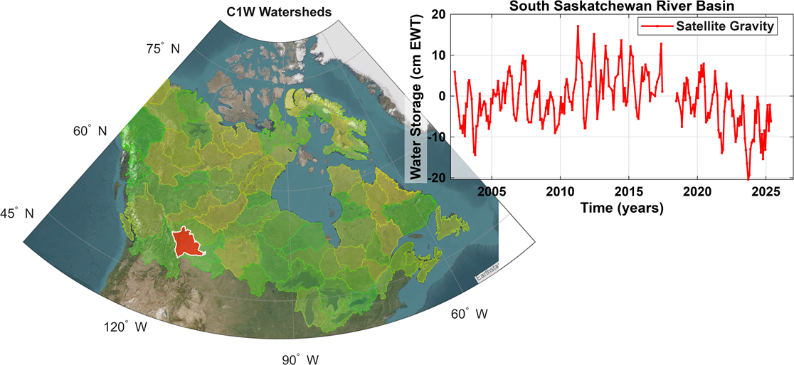
Central to defining mean sea level, CGS’s satellite gravity program now also support NRCan’s Groundwater Geoscience Program, as highlighted in recent Canada Water Act Annual reports to Parliament. CGS Gravity Recovery and Climate Experiment (GRACE) products are available through the Canada1Water Data Portal.
Description of figure
Map of Canada illustrating 70 major watersheds, with individual basins delineated across the country. The South Saskatchewan River Basin is highlighted in red in southern Alberta and Saskatchewan. An inset graph shows time series of satellite-derived water storage anomalies from GRACE, expressed in cubic kilometres, for the period approximately 2002 to 2025. The graph indicates significant variability, with recent values reaching record lows, consistent with severe drought conditions in the basin.
This figure illustrates the 70 major watersheds and highlights the South Saskatchewan River Basin, where GRACE indicates record-low water levels in recent years, underscoring the severity of the ongoing drought.
Protection of Canada’s oceans
Canada’s oceans are vital to our environment, economy, and cultural heritage. They support diverse ecosystems, sustain coastal communities, and play a critical role in regulating the global climate. The SGB is committed to advancing initiatives that safeguard marine environments while ensuring sustainable use of ocean resources. The SGB sets standards and manages surveys for development (such as exploration for, and extraction of, oil and gas) on Canada Lands in the offshore.
Marine boundary service (MBS) project
The SGB has been working on a project designed to provide a framework to address some of the issues identified in the Federal Workshop on Marine Spatial Governance 2021–2022 that included 18 federal departments and agencies. The SGB put in place the foundations of an MBS to support emerging tenure and spatial planning regimes in Canada’s ocean spaces.
We have been making this investment as the offshore continues to be an area that is experiencing growth and demand. Canada has committed to protecting 30% of the ocean space by 2030 and at the same time new energy and economic opportunities are being explored. Examples of new offshore governance that were developed to foster emerging opportunities include:
- The Western Arctic Tariuq (Offshore) Accord, which aims to improve the Northern voice for offshore energy development in the Beaufort Sea. The Accord is a collaboration between Canada, the Inuvialuit Regional Corporation (IRC), and the Yukon and Northwest Territories.
- The signing of a Memorandum of Understanding (MOU) on offshore wind energy by the Government of Canada and the Government of Newfoundland and Labrador. This MOU helps to define the relationship between the two governments and how to effectively regulate renewable projects.
These examples, along with others provided the backdrop to explore relationships, collaborations, and efficiencies in land (space) administration and boundary requirements in the ocean environment.
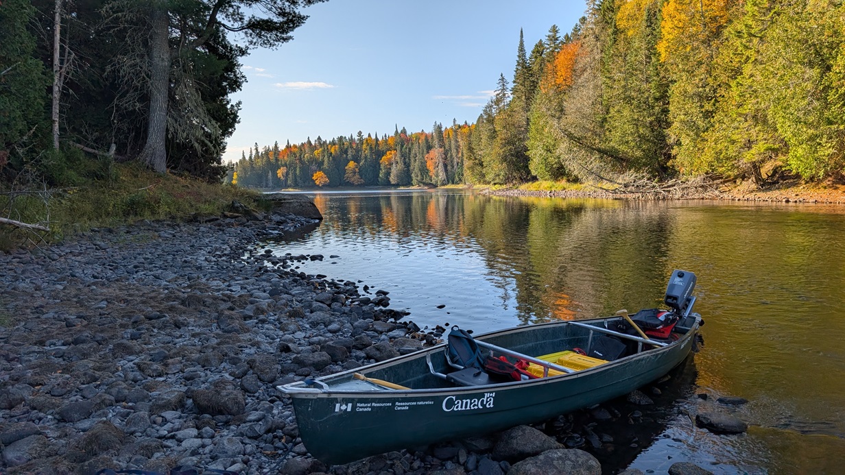
A small green Government of Canada canoe is pulled up along a rocky riverbank, carrying fieldwork gear in a remote setting.
The results of the MBS project included outcomes in the categories of legal boundary descriptions made by professionals and the standards relating to boundary data. The MBS project team made presentations to the Marine Conservation teams at the Department of Fisheries and Oceans (DFO) and Parks Canada Agency (PCA). The MBS project team stressed the importance of involving qualified surveyors in their projects as early as possible and having conservation area descriptions drawn up in compliance with good survey practice. Working with our stakeholders on these issues will be part of the ongoing process of providing advice and guidance to help facilitate continued improvement. In addition, the MBS project team worked with DFO and PCA teams to understand and adapt the survey products to their needs. For example, the MBS project team worked with all stakeholders to establish a methodology for calculating the area of conservation areas that aligns with conservation sector practices. Working within the SGB was also essential as the MBS project team coordinated the SGB Regional Offices that are working on marine projects to define and harmonize marine conservation area description practices. Furthermore, the MBS project team worked on collaboration agreements with DFO Marine Conservation and the NRCan Offshore Management Division.
As both economic development and conservation work continue to develop opportunities in the ocean space, we will monitor and engage with federal administrators on boundary requirements to support the diverse activities taking place in Canada’s oceans.
Responding to current and future challenges
The SGB operates in a dynamic environment where policy, science, and operational requirements must continually evolve to address emerging priorities. Today’s challenges—including evolving legislative and policy changes, the shifting geopolitical environment, climate change, rapid technological advancement, and pressures on human resource capacity—require proactive strategies to ensure the SGB’s three business lines continue to deliver services that are relevant, evidence-based, resilient, and inclusive. These pressures align with the federal government’s broader direction to strengthen Canada’s economic and security relationship with the United States, safeguard national sovereignty, advance reconciliation with Indigenous Peoples, and advance more adaptive and innovative governance approaches that reflect the complexity of today’s environment.
U.S. external policy impacts
The Government of Canada is committed to establishing a new economic and security relationship with the United States and strengthening our collaboration with allies around the world. The SGB is advancing programs that leverage international collaboration while remaining firmly aligned with national priorities, particularly the protection of sovereign security and strengthening of domestic capabilities.
The Government of Canada’s December 2024 Border Plan, which includes a $1.3 billion investment in enhanced border security, has resulted in a notable increase in demands on the Canadian Section of the IBC. Since late 2024, law enforcement agencies have increasingly requested additional boundary maintenance activities, placing added pressure on existing resources. While the Canadian Section continues to support planned and emerging requirements, the evolving scope and intensity of these demands underscore the need to reassess current funding levels to ensure the international boundary can be maintained in accordance with treaty obligations and to respond effectively to new expectations from external stakeholders.
On the geodetic side, U.S. government shutdowns have disrupted elements of CSRS modernization, although modernization milestones are still expected to proceed broadly in parallel with U.S. modernization in early 2027. At the same time, a renewed Government of Canada emphasis on sovereignty, security, and defence has increased demand for reliable, authoritative geodetic services to reduce dependence on U.S. GPS and other externally sourced geodetic information. These factors have raised expectations for system availability, digital modernization, and service continuity, placing additional pressure on existing geodetic assets and resources. The increasing urgency and criticality of these demands, coupled with decades of declining investment in the national geodetic supply chain, are driving the SGB to pursue sustained resourcing to ensure Canada’s geodetic systems remain reliable, secure, and fit for purpose in support of national objectives and client priorities.
Climate impacts
Climate change is increasingly influencing land management and geospatial practices, presenting challenges for the SGB. Rising temperatures, shifting precipitation patterns, more frequent extreme weather events, and devastating forest fires are altering landscapes, impacting boundary monuments and field operations, and increasing the need for accurate, reliable, and current geodetic frameworks. These changes demand adaptive strategies to ensure that cadastral systems, legal boundaries, geodetic infrastructure, and land parcel data remain precise and accessible in the face of environmental variability, and that modern geodetic frameworks can detect and monitor these shifts with the precision offered by current technologies. Understanding these impacts is essential for maintaining the integrity of Canada’s land administration system and supporting sustainable development.
In 2025, Canada experienced its second most severe wildfire season on record, with more than 7.3 million hectares burned across several provinces and territories. The SGB Field teams adjusted schedules, rerouted travel, and modified work plans to ensure staff safety while maintaining continuity of essential boundary and land-related activities.
Changing technologies and artificial intelligence (AI)
Technology is advancing at an unprecedented pace, and AI is at the forefront of this transformation. For the SGB, these innovations are more than trends, they are tools that enhance precision, streamline processes, and unlock new insights into Canada’s land framework. From modernizing boundary management to leveraging geospatial intelligence, AI is helping us move beyond traditional methods towards smarter, data-driven solutions. As we embrace these changes, the SGB’s commitments remain the same: ensuring Canadians have continuous access to a secure and reliable land survey system on Canada Lands, clearly defined boundaries, and accurate positioning information to meet Canada’s economic, social, and environmental needs.
Building human resources capacity
The SGB’s staff are located across Canada, operating out of ten Regional Offices, in addition to the CGS, IBC, and CLSS services based in Ottawa. This nationwide presence enables the Branch to work closely with clients and stakeholders, strengthen collaboration, and remain responsive to regional needs and priorities. From 2024 to 2026, the SGB employees were distributed across several occupational groups, including EN-SUR, SE-RES, EC, EG, IT, and AS (see Annex 5. HR Data).
As with many specialized science and operational organizations, the SGB continues to face a tight labour market and significant challenges in attracting qualified professional land surveyors and technologists. To mitigate these HR capacity risks, the SGB has continued the implementation of the Land Surveyor Development Program (LSDP), launched in 2021. This structured recruitment, training, and career-development program is designed to ensure a sustainable supply of qualified Canada Lands Surveyors and to support succession planning across the SGB’s national operations.
Since its inception, the LSDP has onboarded eight candidates: four have successfully completed the program, and four are currently progressing through various stages of completion.
Acronyms
- ACLS
- Association of Canada Lands Surveyors
- AWS
- Amazon Web Services
- CACS
- Canadian Active Control System
- CCA
- Council of Canadian Academies
- CFO
- Chief Financial Officer
- CGS
- Canadian Geodetic Survey
- CGSN
- Canadian Gravity Standardization Network
- CHIS
- Canadian Hazards Information Service
- CIRNAC
- Crown-Indigenous Relations and Northern Affairs Canada
- CLCA
- Comprehensive Land Claims Agreements
- CLSR
- Canada Lands Survey Records
- CLSS
- Canada Lands Survey System
- CSRS
- Canadian Spatial Reference System
- DFO
- Department of Fisheries and Oceans
- DRDC
- Defence Research and Development Canada
- FNLGR
- First Nation Land Governance Registry
- FNLM
- First Nations Land Management
- FAFNLM
- Framework Agreement on First Nation Land Management
- FNLR
- First Nations Land Registry
- FY
- Fiscal Year
- GRACE
- Gravity Recovery and Climate Experiment
- GNSS
- Global Navigation Satellite System
- GPS
- Global Positioning System
- HAS
- High Accuracy Services
- HR
- Human Resources
- IAG
- International Association of Geodesy
- IBC
- International Boundary Commission
- IBP
- Integrated Business Plan
- ICAO
- International Civil Aviation Organization
- IGLD
- International Great Lakes Datum
- IGRS
- International Gravity Reference System
- IGS
- International GNSS Service
- IGSN71
- International Gravity Standardization Net of 1971
- ILA
- Interdepartmental Letter of Agreement
- IMOU
- Interdepartmental Memorandum of Understanding
- INEGI
- Instituto Nacional de Estadística y Geografía (Mexico)
- IRC
- Inuvialuit Regional Corporation
- ISC
- Indigenous Services Canada
- IT
- Information Technology
- LAB
- Lands Advisory Board
- LSDP
- Land Surveyor Development Program
- MBS
- Marine Boundary Service
- MOU
- Memorandum of Understanding
- NAD83
- North American Datum of 1983
- NAPGD2022
- North American-Pacific Geopotential Datum of 2022
- NATRF2022
- North American Terrestrial Reference Frame of 2022
- NGS
- National Geodetic Survey (USA)
- NRCan
- Natural Resources Canada
- PCA
- Parks Canada Agency
- PNT
- Positioning, Navigation, and Timing
- POC
- Planning and Operations Committee
- PPP
- Precise Point Positioning
- QRO
- Quebec Regional Office
- RO
- Regional Offices
- RTK
- Real-Time Kinematic
- SBEO
- Space-Based Earth Observation
- SGB
- Surveyor General Branch
- SGFNLR
- Self-Governing First Nations Land Registry
- SSC
- Shared Services Canada
- TEC
- Total Electron Content
Annex 1: Contact Us
Offices – National Capital Region (NCR)
Surveyor General Office
Natural Resources Canada
10th Floor, 580 Booth Street
Ottawa, Ontario K1A 0E4
Surveyor General: Martin Gingras
Email: martin.gingras@NRCan-RNCan.gc.ca
Canadian Geodetic Survey
Natural Resources Canada
10th Floor, 580 Booth Street
Ottawa, Ontario K1A 0E4
Director: Catherine Robin
Email: catherine.robin@NRCan-RNCan.gc.ca
International Boundary Commission – Canadian Section
Natural Resources Canada
10th Floor, 580 Booth Street
Ottawa, Ontario K1A 0E4
Canadian Commissioner: Martin Gingras
Email: martin.gingras@NRCan-RNCan.gc.ca
Regional Offices
Alberta Regional Office
Natural Resources Canada
2nd Floor, Room 2001, 5320-122 Street NW
Edmonton, Alberta T6H 3S5
Manager: Steve Rogers
Email: steven.rogers@NRCan-RNCan.gc.ca
Atlantic Regional Office
Natural Resources Canada
2nd Floor, 40 Havelock Street
PO box 67
Amherst, Nova Scotia, B4H 3Y6
Manager: Ronald Robichaud
Email: ronald.robichaud@NRCan-RNCan.gc.ca
British Columbia Regional Office
Natural Resources Canada
15th Floor, Room 1501, 1138 Melville Street
Vancouver, British Columbia V6E 4S3
Manager: Cade Brown
Email: cade.brown@NRCan-RNCan.gc.ca
Manitoba Regional Office
Natural Resources Canada
2nd Floor, Room 250, 365 Hargrave Street
Winnipeg, Manitoba R3B 2K3
Manager: Keith Norek
Email: keith.norek@NRCan-RNCan.gc.ca
Northwest Territories Regional Office
Natural Resources Canada
Room 2-230-4, 5101 50th Avenue
PO box 668
Yellowknife, Northwest Territories X1A 2N5
Manager: Cameron Twa
Email: cameron.twa@NRCan-RNCan.gc.ca
Nunavut Regional Office
Natural Resources Canada
#1–1093 Qamaniqtuaq Street
Iqaluit, Nunavut X0A 0H0
Email: mark.hatcher@NRCan-RNCan.gc.ca
Ontario Regional Office
Natural Resources Canada
300–655 Bay Street
PO box 15
Toronto, Ontario M5G 2K4
Manager: Gavin Lawrence
Email: gavin.lawrence@NRCan-RNCan.gc.ca
Quebec Regional Office
Natural Resources Canada
4th Floor, Room 401
320 Saint-Joseph Street East
Quebec, Quebec G1K 8G5
Manager: Eric Groulx
Email: eric.groulx@NRCan-RNCan.gc.ca
Saskatchewan Regional Office
Natural Resources Canada
701-1783 Hamilton Street
Regina, Saskatchewan S4P 2B6
Manager: Akbarali Karsan
Email: akbarali.karsan@NRCan-RNCan.gc.ca
Yukon Regional Office
Natural Resources Canada
Suite 225, 2nd Floor, 300 Main Street
Whitehorse, Yukon Y1A 2B5
Manager: Elden Pfeiffer
Email: elden.pfeiffer@NRCan-RNCan.gc.ca
Annex 2: Program Metrics
The SGB metrics – Canada Lands Survey System
General metrics
To maintain the CLSS and the land registries across Canada, the SGB conducts various important daily operations represented by the metrics in the following table. This work provides the foundation for all the projects and programs that support the SGB’s three strategic priorities.
| Measured output | FY 2024–2025 | FY 2025–2026 |
|---|---|---|
| New parcels created in cadastral datasets | 6,379 | 5,494 |
| Parcels maintained | 338,063 | 343,263 |
| Survey instructions issued | 831 | 833 |
| Documents registered in the Canada Lands Survey Record | 1,526 | 1,645 |
Saskatchewan Treaty Land Entitlement
Treaty Land Entitlement claims can be submitted by First Nations that did not receive all the land they were entitled to under treaties signed by the Crown. In Saskatchewan, much of this land has already been surveyed in the province’s township system. The SGB is responsible for reviewing these parcels to identify and resolve any ambiguities or related issues.
| Measured output | FY 2024–2025 | FY 2025–2026 |
|---|---|---|
| Area of parcels described (surface plus minerals) | 6,169 ha | 9,804 ha |
| Lands added to the reserve (surface plus minerals) | 1,991 ha | 1,651 ha |
Manitoba Treaty Land Entitlement
In Manitoba, a significant proportion of the treaty land that First Nations are entitled to has yet to be surveyed. Canada is responsible for surveying this Crown land, and the SGB provides technical and professional guidance to define land selections and ensure that Canada adheres to its treaty obligations. The progress of this work is measured by the metrics in the following table.
| Measured output | FY 2024–2025 | FY 2025–2026 |
|---|---|---|
| Area of parcels described | 1,817 ha | 458 ha |
| Lands added to the reserve | 1,843 ha | 198 ha |
FNLM metrics
These metrics represent the work carried out to help provide certainty over the extent of lands a First Nations administers through the Framework Agreement on First Nations Land Management (FAFNLM).
| Measured output | FY 2024–2025 | FY 2025–2026 |
|---|---|---|
| Land descriptions recorded | 16 | 62 |
| Research reports sent to Indigenous Services Canada and First Nations | 14 | 28 |
| Additional land descriptions completed but not yet recorded | S.O. | 28 |
Memorandum of Understanding and survey contracts to the private sector
To support the mandate and obligations of our partners in other government departments, certain of the SGB activities are carried out at cost recovery. The figures in the following table are indicators of the work accomplished in this context. Most survey contracts issued to the private industry are a result of these Interdepartmental Memoranda of Understanding (IMOU).
| Measured output | FY 2024–2025 | FY 2025–2026 |
|---|---|---|
| Contracts | 85 | 82 |
| Value | $1,886,009 | $1,889,716 |
Service standards
CLSS service standards are the level of performance you can reasonably expect to encounter under normal circumstances. The SGB has developed these standards as part of our ongoing commitment to quality client service. The SGB service standards include issuing survey instructions, recording survey documents in CLSR, and updating cadastral datasets (new survey plans).
Issuing survey instructions
This is a timeliness service standard for processing survey instruction requests received from Canada Lands surveyors. Our standard applies to complete requests for survey instructions made from the MyCLSS website. This standard only applies to survey instruction requests that contain all the required information.
- Our standard: We issue survey instructions within two business days of receiving the request.
- Our target: We aim to meet this standard ≥ 95% of the time.
- In 2024–2025, the SGB issued survey instructions within two business days 98% of the time.
- In 2025–2026, the SGB issued survey instructions within two business days 98% of the time.
Recording survey documents in Canada Lands Survey Records (CLSR)
This is a timeliness service standard for recording a survey document (survey plan, field notes and/or report) in the CLSR after it has been approved or confirmed by the SGB. A survey document is recorded once a CLSR number is assigned to it.
The day a recording request is made is not included in this time limit. This service standard does not apply to survey documents related to surveys under the Land Titles Act (Nunavut), Land Titles Act (Northwest Territories), or Land Titles Act (Yukon).
- Our standard: We record survey documents within two business days from the date it is approved or confirmed.
- Our target: We aim to meet this standard ≥ 95% of the time.
- In 2024–2025, the SGB recorded survey documents within two business days from the date it was approved or confirmed 89% of the time.
- In 2025–2026, the SGB recorded survey documents within two business days from the date it was approved or confirmed 82% of the time.
Although performance against the two-business-day service standard declined during the reporting period, overall plan recording operations remained stable and responsive. In southern Canada, 95% of plans continued to be recorded within three business days, indicating that service delivery remained within an acceptable operational range. In the North, modest increases in recording times were observed, reflecting additional procedural requirements associated with integration with territorial land title offices.
Updating cadastral datasets: New survey plans
This is a timeliness service standard for updating the cadastral datasets once a new survey document is recorded in the CLSR. This update operation begins when a digital image of the new document is available in the Survey Records Information System. The standard only applies to new survey documents recorded in the CLSR. Once dataset updates are complete, the distribution process of the updated data takes place.
The number and complexity of the parcels involved in the new survey plan influence the time to update.
- Our standard: Subject to the number and complexity of the parcels involved on the survey document, we complete the update within 15 working days from the date the digital image is available.
- Our target: We aim to meet this standard ≥ 75% of the time.
- In 2024–2025, the SGB completed the update within 15 working days from the date the digital image was available 93% of the time.
- In 2025–2026, the SGB completed the update within 15 working days from the date the digital image was available 92% of the time.
The SGB metrics – Canadian Geodetic Survey
The following metrics are derived from the CGS Performance Indicator Profile and will serve as a key reference point for future evaluations. These indicators are used to monitor the quality and relevance of CGS products and services as technologies evolve. They are aligned with the Division’s expected immediate outcomes (providing accessible, accurate and timely geodetic information) and intermediate outcomes (georeferencing to a common Canadian reference system consistent with international standards).
| Measured output | Target | FY 2024–2025 | FY 2025–2026 |
|---|---|---|---|
| GNSS stations for which data are distributed | ≥112 | 156 | 183 |
| Accuracy of GNSS orbits with respect to international standards | <2 cm | 1.1 cm | 0.89 cm |
| GNSS stations used for reference frame and velocity computations | >330 | 342 | 336 |
| Availability of the Canadian Active Control System (CACS) daily data files (within 30 minutes after the end of the day) | >90% | 92% | 97% |
| Availability of rapid orbit and clock products (within 12 hours after the end of the day) | >95% | 99% | 100% |
| Measured output | Target | FY 2024–2025 | FY 2025–2026 |
|---|---|---|---|
| Direct users of CGS data products | ≥7,000 | 13,212 | 15,332 |
| Requests for CGS products and services | 300,000 | 2,616,222 | 4,743,829 |
| Commercial GNSS reference stations monitored by CGS as part of the real-time kinematic (RTK) compliance program | >500 | 660 | 794 |
Annex 3. Publications
- Ahlgren, K., Wang, Y. M., Li, X., Hardy, R. A., Huang, J., Foroughi, I., Véronneau, M., & Avalos Naranjo, D. (2024). Current status of GEOID2022—A new basis for heights throughout North America. AGU Fall Meeting Abstracts, 2024, G31A-08.
- Ajourlou, A., Darbyshire, F., Audet, P., & Milne, G. A. (2024). Structure of the crust and upper mantle in Greenland and northeastern Canada: Insights from anisotropic Rayleigh-wave tomography. Geophysical Journal International, 239(1), 329–350. https://doi.org/10.1093/gji/ggae269
- Ajourlou, A., Milne, G. A., Love, R., Afonso, J. C., Salajegheh, F., Latychev, K., Kjeldsen, K. K., Lepipas, A., Martos, Y. M. & Woodroffe, S. A. (2025). Upper mantle temperatures illuminate the Iceland hotspot track and understanding of ice–Earth interactions in Greenland. Proceedings of the National Academy of Sciences of the United States of America, 122(50), e2504752122. https://doi.org/10.1073/pnas.2504752122
- Avalos-Naranjo, D., Muñoz-Abundes, R. & Huang, J. (2024, November 6–8). Stokes–Helmert approach for geoid modelling over Mexico and the southern USA [Invited presentation]. Workshop on Asia-Pacific Gravity, Geoid and Vertical Datum, Manila, Philippines.
- Bagherbandi, M., Sjöberg, L. E., Abd El-Gelil, M., & Foroughi, I. (2025). Investigating surface gravity and height variations due to glacial isostatic adjustment: A comparative study using GRACE, GRACE-FO, and absolute gravity data in Canada and Fennoscandia. Science of Remote Sensing, 100285.
- Chapman, G., Milne, G. A., Parang, S., Ajourlou, P., Love, R., Gunn, A. & Tarasov, L. (2025). The contribution of glacial isostatic adjustment to relative sea-level rise and land subsidence along the Atlantic coast of Europe. Quaternary Science Reviews, 369, 109577.
- Crowley, J. W., Bunn, M., Frey, S., Russell, H. A. J. & Huang, J. (2024, September 4–6). Towards integrated gravity–water storage change models for regional and national scale monitoring. GGHS2024, Thessaloniki, Greece.
- Elson, E., Ghoddousi Fard, R., Kamali, O., Lamothe, P., Maia, E., Mireault, Y. & Nikolaidou, T. (2025). NRCan Analysis Center technical report 2024. In R. Dach & E. Brockman (Eds.), International GNSS Service technical report 2024 (IGS annual report). IGS Central Bureau & University of Bern. https://doi.org/10.48350/191991
- Foroughi, I., Goli, M., Ferguson, S. & Pagiatakis, S. (2025). Geoid determination using airborne vector gravimetry: Insights from a real dataset. Studia Geophysica et Geodaetica, 69(2), 101–117.
- Foroughi, I., Huang, J., Véronneau, M., Papasodoro, C. & Robin, C. (2025). An update to the Canadian Vertical Datum. Abstracts of the ICA, 10, 78.
- Foroughi, I., Huang, J., Véronneau, M., Wang, Y., Li, X., Ahlgren, K., Hardy, R. & Avalos-Naranjo, D. (2025, September 1–5). GEOID2022 alpha debrief and its error estimate. IAG Scientific Assembly 2025, Rimini, Italy.
- Foroughi, I., Véronneau, M., Huang, J. & Pavlic, G. (2024, May). Advancements in gravity datasets from the Canadian Gravimetric Geoid 2013a to GEOID2022 beta. Canadian Geophysical Union Annual General Meeting, Ottawa, Canada.
- Ghoddousi Fard, R. (2024, July 13–21). Galileo High Accuracy Service and other public real-time precise GNSS correction products: A real-time PPP assessment over Canadian stations. COSPAR 45th Scientific Assembly, Busan, South Korea.
- Ghoddousi-Fard, R. (2025). Real-time GNSS PPP with different correction streams during ionospheric disturbances over the Canadian region. Beacon Satellite Symposium 2025, Rome, Italy, November 10–14, 2025.
- Goli, M. & Foroughi, I. (2025). FGrS: A software for fast gravimetric ultra-high spherical harmonic synthesis. Earth Science Informatics, 18(2), 419.
- Goli, M., Foroughi, I., Pagiatakis, S., Ferguson, S., & Novák, P. (2025). Geoid determination using airborne gravity vectors. Earth, Planets and Space, 77(1), 167.
- Goudarzi, M. A. (2025). Evaluating Euler pole parameters for the North American Terrestrial Reference Frame of 2022. Geodesy and Geodynamics, 16(6), 681–692. https://doi.org/10.1016/j.geog.2025.03.004
- Goudarzi, M. A., Bennett, R., Craymer, M., Gillins, D., Bond, J., Piraszewski, M., Amjadiparvar, B., & Bremner, M. (2025). Euler pole parameters of the North American Terrestrial Reference Frame of 2022 (NATRF2022). Journal of Surveying Engineering.
- Huang, J., Foroughi, I., Véronneau, M., Crowley, J. W., Wang, Y. M., Li, X., Ahlgren, K., et al. (2024). Combination of airborne GRAV-D data into GEOID2022 using CGS and NGS approaches. AGU Fall Meeting Abstracts, G31A-07.
- Li, X., Novák, P., Lin, M., Vergos, G., Sneeuw, N., Santos, M., Foroughi, I., et al. (2024, September 4–6). Height datum: Definition, new concepts, and standardization. GGHS2024, Thessaloniki, Greece.
- Love, R., Milne, G. A., Ajourlou, P., Parang, S., Tarasov, L. & Latychev, K. (2024). A fast surrogate model for 3-D Earth glacial isostatic adjustment using TensorFlow artificial neural networks. Geoscientific Model Development, 17(23), 8535–8551.
- Nsiah Ababio, A. N., Foroughi, I., Tenzer, R., & Bagherbandi, M. (2024). A conversion of the geoid to the quasigeoid at the Hong Kong territories. Applied Geomatics, 16(3), 471–483.
- Parang, S., Milne, G. A., Tarasov, L., Love, R., Yousefi, M. & Vacchi, M. (2024). Constraining models of glacial isostatic adjustment in eastern North America. Quaternary Science Reviews, 334, 108708.
- Parang, S., Milne, G. A., Crowley, J. W. & Karegar, M. A. (2024, May). Towards an improved understanding of vertical land motion in central eastern North America. Canadian Geophysical Union Annual Scientific Meeting, Ottawa, Canada.
- Philippe, E. G. H., Abd El-Gelil, M., D’Aoust, B., & Crowley, J. W. (2025). Advancements in gravimetry: Comparing results from traditional absolute gravimeters with Canada’s first quantum gravimeter. Canadian Geophysical Union Annual Meeting (CGU 2025).
- Piraszewski, M., Bond, J. D., Craymer, M., Amjadiparvar, B., Bremner, M., Goudarzi, M. A., Lapelle, E., Simon, K., & Zhao, Y. (2025, September 1–5). NATRF2022 based on Repro3 re-processing—A modern terrestrial reference system for Canada. IAG Scientific Assembly 2025, Rimini, Italy.
- Prikryl, P., McCaffrey, A. C. M., Weygand, J. M., Ghoddousi Fard, R., Billett, D., Spanswick, E., & Houghton, J. (2026). GPS phase and amplitude scintillation at high latitudes during the extreme geomagnetic storm of May 2024. Earth, Planets and Space (Manuscript submitted for publication).
- Robin, C. (2025, May). Modernization of heights above sea level and other spatial references: Implications for geospatial and hydrospatial data [Plenary lecture]. Canadian Geophysical Union Annual Scientific Meeting, Saskatoon, Canada.
- Robin, C., Bond, J., Crowley, J., Donahue, B. & Huang, J. (2025). Modernized CSRS products for 2026: What’s new? Association of Canada Land Surveyors (Webinar).
- Robin, C., Bond, J., Crowley, J., Donahue, B. & Huang, J. (2025). Produits SCRS modernisés pour 2026 : Quoi de neuf ? Association des arpenteurs des terres du Canada (Webinaire).
- Robin, C., Bond, J., Crowley, J., Donahue, B., Huang, J. & Moreau, J.-S. (2025). CSRS modernization: A new coordinate reference system for Canada. Abstracts of the ICA, 10, 240.
- Robin, C., Bremner, M., Bond, J., Craymer, M., Foroughi, I., Huang, J., Goudarzi, A., Simon, K. & Yousefi, M. (2024, May). National Reference System modernization in 2025: An overview of CGS efforts towards the definition and implementation of the new CSRS. Canadian Geophysical Union Annual General Meeting, Ottawa, Canada.
- Sanchez, L., Vergos, G., Barzaghi, R., Huang, J., Ågren, J., Erol, B., & Tocho, C. (2025, September 1–5). Challenges and achievements in establishing the International Height Reference Frame (IHRF). IAG Scientific Assembly 2025, Rimini, Italy.
- Simon, K., Bond, J., Craymer, M., Amjadiparvar, B., Bremner, M., Lapelle, E., Piraszewski, M., & Zhao, Y. (2025). The new NAD83v80VG velocity model using an updated velocity field for Canada. Geomatica, 77(2), 100087. https://doi.org/10.1016/j.geomat.2025.100087
- Tenzer, R., Nsiah Ababio, A. N., Foroughi, I., Pitoňák, M., Novák, P., Chen, W., & Ghomsi, F. E. K. (2025). On the accurate determination of the orthometric correction to levelled height differences—A case study in Hong Kong. Geomatics, 5(4), 71.
Annex 4. Awards
This annex celebrates the accomplishments of the SGB teams and employees whose outstanding contributions were recognized during the 2024–2025 and 2025–2026 FYs. These awards highlight the skill, dedication, and leadership demonstrated across the Branch.
In 2024, the Lands and Minerals Sector honoured the SGB colleagues for their outstanding achievements and dedication to the Sector and Canadians. The SGB modernized the Canada-U.S. border along the Saint John River, mapping 119 kilometres in just four years—16 years faster than expected. Using advanced surveying and GNSS technology, the project eliminated traditional method errors, proving the new approach’s effectiveness for future border sections. The team’s dedication and sacrifices highlight strong cross-border cooperation and commitment to preserving territorial integrity.
In 2025, the SGB was presented the National Geomatics Award for Public Sector Leadership. Voted as the winner among five organizations, the award recognized NRCan for “Advancing Canada’s geospatial foundations by enhancing the Canadian Spatial Reference System, modernizing the Canadian Geospatial Data Infrastructure through GeoConnections, and expanding GEO.ca. NRCan is also strengthening wildfire and climate resilience with updated burned area mapping, flood mapping, and geospatial tools for emergency response.”
In 2026, the SGB was recognized with a Sector award for the completion of the SGB’s five-year SBEO project, which marks a major milestone for NRCan, doubling its real-time GPS ground station network across the country. This expanded infrastructure delivers critical GPS data, products, and services that underpin activities ranging from surveying and construction to land and water management, monitoring the movement of the Canadian landmass, and observing atmospheric and space weather phenomena—especially needed in remote and Northern areas where such data is limited. The SBEO team overcame substantial logistical and project management challenges, installing 20 new bedrock-anchored stations in some of the country’s most remote and infrastructure-poor regions. Along the way, the team was rewarded with stunning scenery and memorable connections with the communities they worked alongside. Together, these new stations create valuable new access points to the CSRS, enhancing its performance while deepening our understanding of Earth and atmospheric processes across Canada.
The SBG received an Instant Award for their exceptional work on the Section 35 Land Surveys in support of Comprehensive Land Claims. The SGB successfully obtained Treasury Board approval to access the Section 35 Rights Funding Envelope to complete surveys for lands outstanding for 20 First Nations under nine land claims agreements. The team worked closely with colleagues in the Chief Financial Officer (CFO) sector and CIRNAC, and Central Agencies, coordinating efforts to provide comprehensive and timely information, harmonizing messaging from across multiple areas of the Branch, and preparing clear, well-structured briefing materials for senior management to support decision-making and advance the initiative through approval processes.
Annex 5. Human Resources Data
The following tables provide a breakdown of all the SGB occupational groups of employees in the 2024–2025 and 2025–2026 FYs. In comparison to the last annual report where we reported 157 employees, the SGB had a slight increase in both the 2024–2025 and 2025–2026 FYs with 161 and 160 employees, respectively.
The table below provides a more detailed breakdown of occupational groups during the last two FYs.
| Acronym | Group | 2024/25 | 2025/26 |
|---|---|---|---|
| AS | Administrative Services | 8 | 7 |
| CR | Clerical and Regulatory | 2 | 2 |
| EC | Economics and Social Science Services | 3 | 3 |
| EG | Engineering and Scientific Support | 25 | 25 |
| EN-SUR | Engineering and Land Survey | 102 | 104 |
| EX | Executive | 3 | 3 |
| GLMAN | General Labour and Trades | 3 | 3 |
| IT | Information Technology | 9 | 9 |
| PC | Geodetic Technologist | 1 | 0 |
| PM | Program Coordinator | 1 | 1 |
| SERES | Scientific Research | 2 | 2 |
| Student | Student | 2 | 1 |
| Total | 161 | 160 |