
How climate change is reshaping Canada’s water systems, according to the latest national climate assessment
October 2026
Canada’s climate is changing, and scientists are observing the effects across the country. From rising temperatures and shifting precipitation patterns to changes in glaciers, permafrost, snow and ice cover, and sea levels, researchers are assembling the evidence to build a clearer picture of how Canada’s climate and water systems are evolving and what changes may lie ahead in the coming decades.
The latest evidence: Canada’s Changing Climate Report 2026
Their findings have been brought together and made public in Canada’s Changing Climate Report 2026 (CCCR 2026), which closely examines changes of various kinds. In the case of annual average air temperatures, for example, these have risen almost everywhere in Canada since the mid-20th century and are expected to continue rising.
The effects of these warming temperatures are significant and are already being noticed almost everywhere: from more extreme heat, increased precipitation and earlier peak stream flow to shorter snow and ice cover seasons, thinning glaciers, thawing permafrost and rising sea levels.
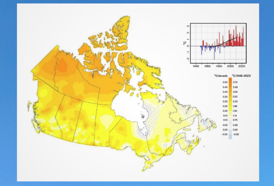
Observed changes in Canada’s annual average daily mean air temperature from 1948 to 2023. The map shows warming across most of the country, with some of the largest increases in northern and western Canada, and the graph shows the national temperature trend over the same period. Source, with further details: Figure RS.2 in Report Summary, Canada’s Changing Climate Report 2026.
The report builds on the first CCCR assessment, released in 2019. Since then, scientists have gathered more data and built up the body of evidence showing how human-caused global warming has changed Canada’s climate and what it might look like in the future.
Beyond the data itself, CCCR 2026 brings together advances in our understanding of a wide range of topics and introduces dedicated chapters to extreme weather and climate events, large-scale atmosphere-ocean processes, and the role of the carbon cycle in climate change. The new report also includes place-based case stories from First Nations, Inuit and Métis authors that document Indigenous science, observations and perspectives on the implications of climate change. And it provides practical information on how climate information can be applied in real-world decision-making.
NRCan’s role
Natural Resources Canada (NRCan) leads Canada’s National Assessment Process, to which the CCCR contributes the climate science foundation. This report marks the first release in the fifth assessment cycle.
Led by Environment and Climate Change Canada, CCCR 2026 includes contributions from eight NRCan scientists in the following areas:
- Canada’s water cycle
- Glaciers and permafrost
- The carbon cycle
- Changing sea levels along Canadian coastlines
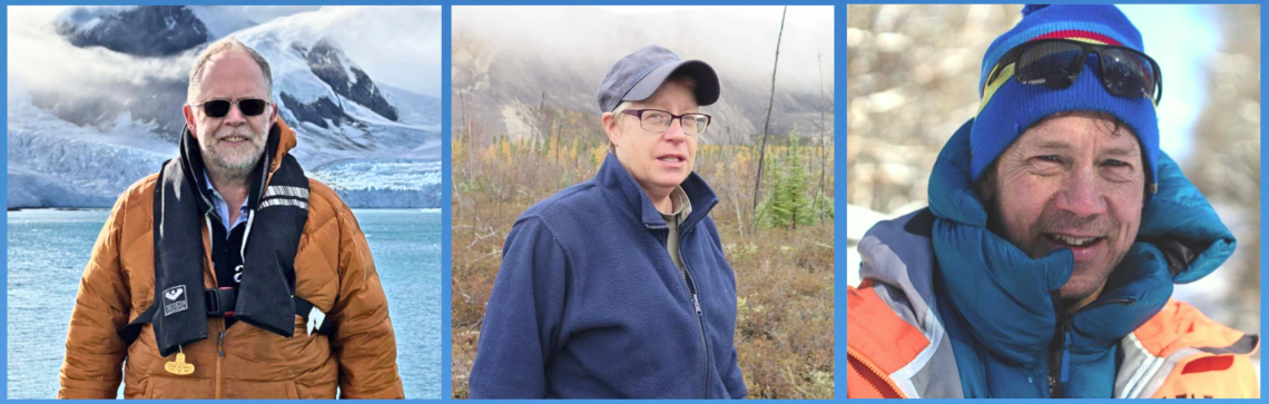
From left: Thomas James, Sharon Smith and David Burgess of the Geological Survey of Canada.
Meet the NRCan researchers behind the report
Three Geological Survey of Canada research scientists — Thomas James, Sharon Smith and David Burgess — were lead authors on sections of this report as well as material in the first CCCR, released in 2019. Their areas of expertise relate to changes in glaciers, sea level and permafrost.
Shrinking glaciers
Iconic landscapes are changing across Canada as the snow and ice that shape them disappear. Scientists have concluded that glaciers in western Canada will largely disappear by the end of this century, a loss that will affect fresh water supply to the headwaters of rivers and streams that flow from this region.
“This report improves our understanding of how Canada’s shrinking Arctic ice caps will contribute to global sea level rise over the coming decades,” says David Burgess.
“Specifically, contributions to global sea-level rise from Canada’s Arctic will continue to increase beyond 2100. In western Canada, extremely hot summers since 2019 have resulted in the highest glacier melt rates on record.”
David points out that these trends are decreasing the volume of the natural water reservoirs that glaciers provide, resulting in a decline in freshwater stream flow in mid to late summer.
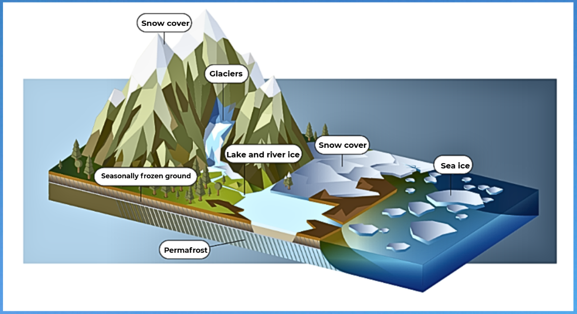
Canada’s cryosphere — areas of frozen water — includes snow cover, glaciers, lake and river ice, seasonally frozen ground and permafrost. Because these parts of the environment are strongly influenced by air temperature, continued warming is expected to intensify snow and ice loss and other changes across the cryosphere. Source: Figure RS.12 in Report Summary, Canada’s Changing Climate Report 2026.
Canada’s Arctic and western glaciers do more than shape the landscape: they also help store and regulate freshwater. During hot, dry summers, glacier melt helps keep rivers and streams flowing. As glaciers continue to shrink rapidly, the impacts will be felt locally and globally through changes to ecosystems, availability of water for agriculture, drinking water supplies and in many other aspects.
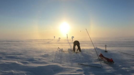
Weather stations in remote Arctic environments help scientists track conditions over time and better understand changes in Canada’s ice and climate. Here, on the Meighen Ice Cap in Nunavut, a researcher services an automatic weather station.
Rising coastal sea levels
Canada’s coastlines are changing, too.
Globally, sea levels have risen by about 20 centimetres since 1900. Along many parts of Canada’s immense coastline — the longest in the world — local sea levels are projected to continue rising, increasing the potential for more coastal flooding and coastal erosion.
“Canada’s three coasts — Atlantic, Pacific and Arctic — have large regions where the sea level is rising and is projected to rise at greater rates in the future,” says Thomas James.
“The Vancouver Metropolitan area, Halifax and the eastern coast of Nova Scotia, and Prince Edward Island are experiencing the effects of rising seas in flooding and coastal erosion. In the Arctic community of Tuktoyaktuk, warming ocean water, reduced sea ice and rising sea levels are contributing to coastal erosion and flooding, leading to the recent installation of coastal defences.”
Thawing permafrost
Other major changes continue to occur beneath the surface, as permafrost thaws.
Permafrost is ground that stays frozen for at least two years in a row. It underlies much of northern Canada and can contain soil, rock and ice that have been frozen for centuries or even many millennia.
There is strong evidence that permafrost is continuing to warm and thaw across northern Canada. As permafrost thaws, the land surface can shift, sink or become unstable — changes that affect entire ecosystems, as well as homes, roads, bridges and other infrastructure.
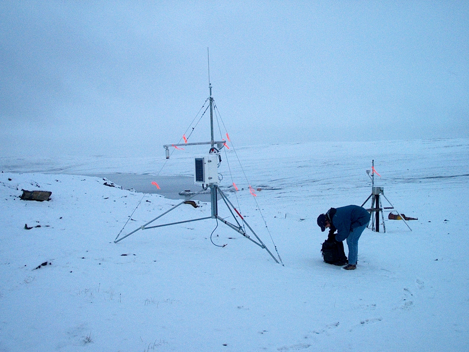
Sharon Smith collects data at the northernmost permafrost temperature monitoring site in the world at Alert, Nunavut. The GSC maintains a network of High Arctic permafrost monitoring sites, including five at Canadian Forces Station Alert.
“In ice-rich terrain, this thawing is leading to landscape changes that have implications for the natural and built environments,” says Sharon Smith. “These include impacts to terrestrial and aquatic ecosystems, traditional lifestyles and infrastructure integrity.”
Pulling it all together
Comprehensive climate science assessments like the CCCR do more than simply document what’s already happened or describe how climate in Canada may change in the future under different scenarios of global warming. They also have the immediate practical value of providing critical information to inform the public and to help governments, communities and decision-makers plan and adapt.
What happens in the future depends on how much additional global warming occurs in the decades ahead. That’s why understanding these changes is an important part of preparing for them and, in turn, why the contributions of NRCan and others in producing Canada’s Changing Climate Report are so valuable: because our understanding is only as good as the science on which it depends.
“This report utilizes a rigorous, evidence-based approach to assess recent and projected glacial trends,” says David. “It provides a vital foundation for implementing proactive, long-term strategies aimed at national water security and risk management.”