
Tracing history on Naskapi Nation traditional territory using optical dating and geoscience
June 2025
By Jackson Lyons, for Simply Science
A unique project has brought together a Natural Resources Canada scientist, along with archaeologists, researchers and Naskapi Nation representatives, to learn more about ancestral Indigenous ways of life in the context of a wider, Naskapi-led project to create a protected area on part of their traditional lands.
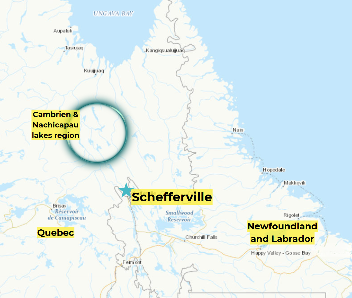
The Cambrien Lake region of Quebec is located in the heart of the traditional territory of the Naskapi Nation of Kawawachikamach and is home to a diversity of ecosystems.
The multidisciplinary team — including NRCan scientist Stephen Wolfe, PhD — set out to better understand the timing and context of ancient archaeological sites found on terraces overlooking Cambrien Lake, a widening of the Caniapiscau River located about 250 kilometres northwest of Schefferville, in northern Quebec.
Stephen, a research scientist with the Geological Survey of Canada (GSC), was part of a small group including consulting archaeologists, two Naskapi technicians and researchers from the Université du Québec à Montréal invited by the Naskapi Nation of Kawawachikamach to participate in a research project in the Cambrien Lake region, a geologically and ecologically remarkable location with mobile dunes, subarctic forests, wetlands and lakes.
The Naskapi have lived in this region for thousands of years, following and intercepting caribou herds across the eastern Subarctic. In historic times, they took part in the fur trade, eventually becoming connected to the Fort Chimo post (now Kuujjuaq) around the 1830s and later to Waskaikinis (Fort McKenzie), northeast of Cambrien Lake, which operated from 1916 to the 1950s. The Naskapi were relocated to the Schefferville, Quebec, region in the 1950s and founded their community of Kawawachikamach in the 1980s.
Following the wind and the sand
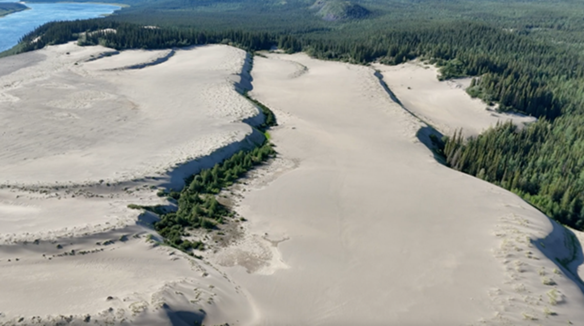
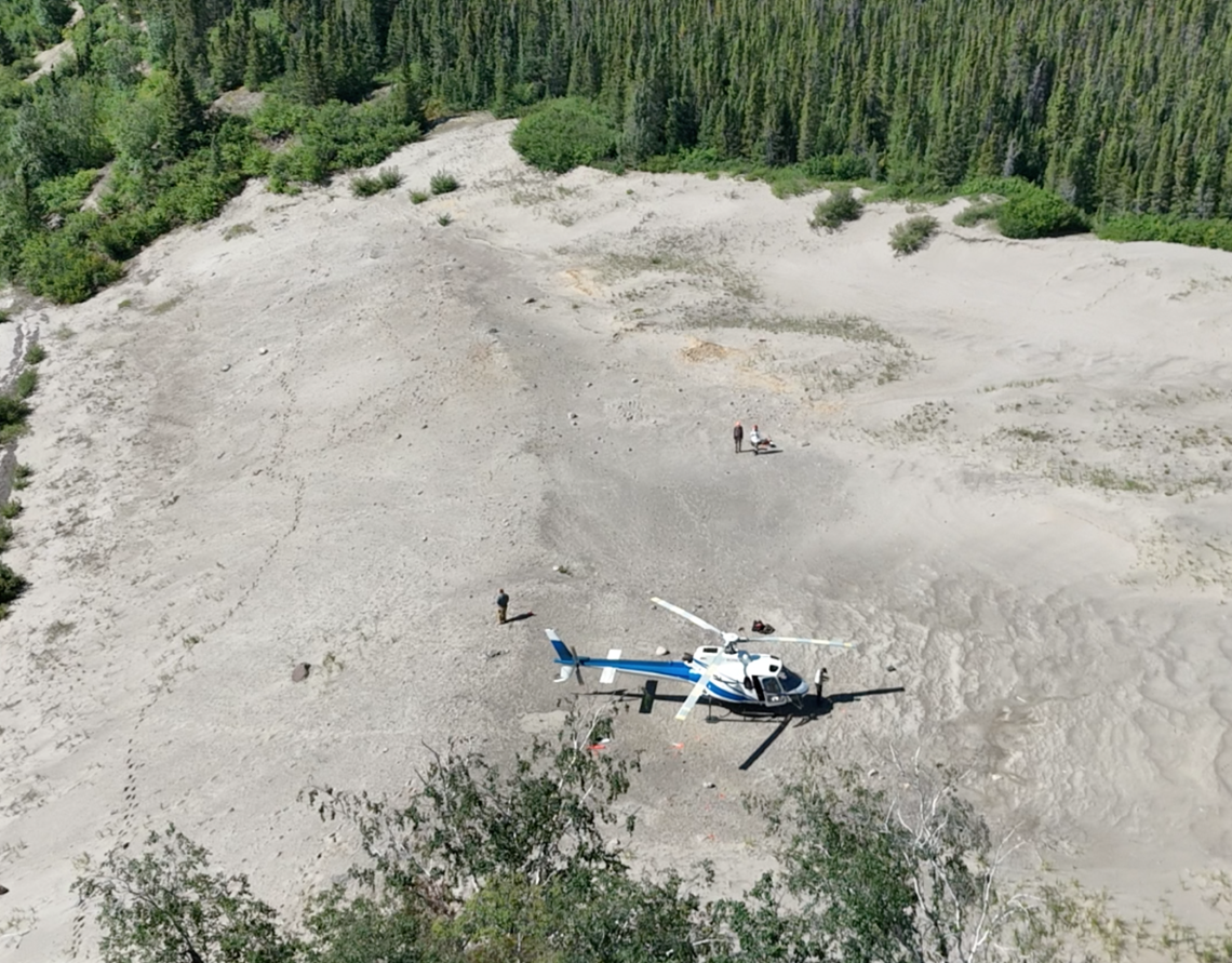
The research team travelled by floatplane from Schefferville to a former fishing camp, then by helicopter to several archaeological sites. Once at the dunes of Cambrien Lake, they examined sediment deposits and land formations to help understand the changes over time on Naskapi traditional lands.
Part of Stephen’s approach involved using aeolian geomorphology — the study of how wind shapes the earth’s surface — to help determine when and how ancestral peoples lived in this area. To do this, he and the team collected geological sediment samples from dune deposits exposed in trenches dug adjacent to archaeological sites.
By analyzing sand grains using a method called optical dating — which determines when grains were last exposed to sunlight — they aim to trace how wind patterns shaped the landscape back through time. The team also searched for fragments of charcoal and burnt animal bones on archaeological sites covered in fire-cracked rocks to help date human occupation in the Cambrien Lake region using radiocarbon dating.
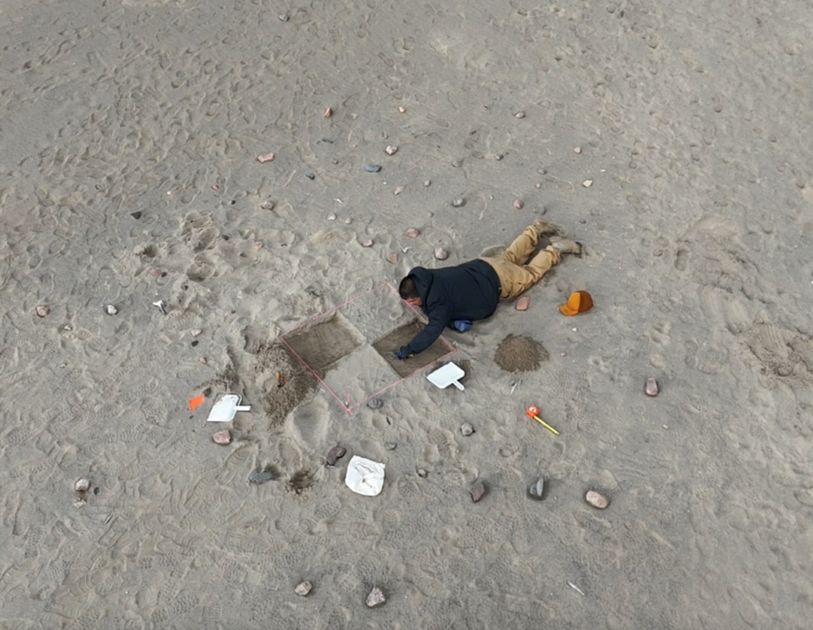
Naskapi technician, Tshiueten Vachon, excavating a small test pit in an area of archeological potential.
The rich archaeological potential of the region had already been confirmed by two field seasons of survey work led by Moira McCaffrey and David Denton, consulting archaeologists, along with Naskapi technicians Tshiueten Vachon, Kabimbetas Noah Mokoush and Jaylen Andre. Together, they recorded more than 50 archaeological sites, including Precontact-period campsites dating back hundreds and thousands of years, as well as impressive fur trade–era sites characterized by large earthen tent rings on the ground where the Naskapi gathered and pitched their tepees in the late 19th and early 20th centuries. These foundational archaeological findings were crucial to the success of this broader interdisciplinary project.
A range of other findings — preliminary onsite observations, radiocarbon dating of calcined (burnt) animal bones and a recent analysis of sediment deposits — suggests that Indigenous groups lived on beaches near the shoreline as far back as 5,000 years ago.
The research team travelled by helicopter to reach archaeological sites in the Cambrien Lake region. These ancient occupation sites are characterized by fireplaces filled with fire-cracked rocks and scatters of stone tools and flaking debris. The sites, which confirm the deep human history of the region, are endangered by wind and sand erosion.
A unique expedition with unique challenges
This was no ordinary field trip. The team could only reach the remote research site during a brief window in the summer when weather was warm and calm enough to travel. In addition, they had just eight working days to study site contexts, dig exploratory trenches adjacent to archaeological sites and collect samples for optical dating. And while the team benefited from the generally rain-free weather, they had to stay alert after an early black bear encounter at camp!
Connecting with the past
Stephen saw first-hand the impact that this discovery had on the local youth and other community participants in this project. For many, it was a rare opportunity to walk the land of their ancestors — land that’s almost inaccessible without air travel; in winter, for example, the trip from Schefferville takes nearly two full days by snowmobile.
And for many it was a deeply moving experience. “To be in the motherland of the ancestors of the Naskapi people, their home, their land — it made me feel more in touch with my identity as a Naskapi person,” says Tshiueten Vachon, one of the technicians on the project. “It wasn’t by luck that we found beads. A person who’s experienced in hunting and other activities in the outdoors would have experience in tracking or searching for previous signs of occupation.”
The project was a major undertaking, and Stephen credits the Naskapi Nation for organizing it and selecting the lead archaeologists, Moira and David, who coordinated everything. “Without them, we wouldn’t have had a field season,” he says.
“Just being able to go for a walk together, look at the land and connect — it was so important for all of us,” says Stephen.
As an external participant, Stephen says he feels honoured to experience the Naskapi people’s ancient home with members of the community. “That’s the most rewarding thing: to be able to spend time with the people whose home it is, and on land they are sharing with you.”
What’s next?
Stephen is preparing a formal scientific report on the project’s many results and working on a video using drone footage and landscape clips to present to the Naskapi community. He hopes this record will serve as a visual connection to their ancestral territory — especially for Naskapi Elders who are unable to make the journey themselves. This productive collaboration is not only uncovering evidence of an ancient way of life — it’s also helping to reconnect a community with its ancestral land.
For Stephen, it was a rare and meaningful opportunity to contribute to a shared story that bridges modern science and ancient Indigenous history. “In the end, it’s not just about what we discovered in the ground,” he says. “It’s about the people, the place and the connections between them over time.”
For more information on this research contact us at sciencecommunications-communicationsscientifiques@nrcan-rncan.gc.ca.
Discover more:
Stephen Wolfe on ResearchGate
David Denton — Independent Researcher
Moira McCaffrey — Independent Researcher
Cambrien and Nachicapau lakes region - SNAP Québec