
As a surveyor for the International Boundary Commission, Joe Harrietha “works the line” in locating and maintaining the vast Canada–United States border. The Canadian section of the Commission is part of Natural Resources Canada, and he’s worked in some of the most remote and scenic areas in Canada for more than 25 years. These photos are from some of his expeditions. Read his personal account of one of these missions here.
Click on an image to view a larger size.
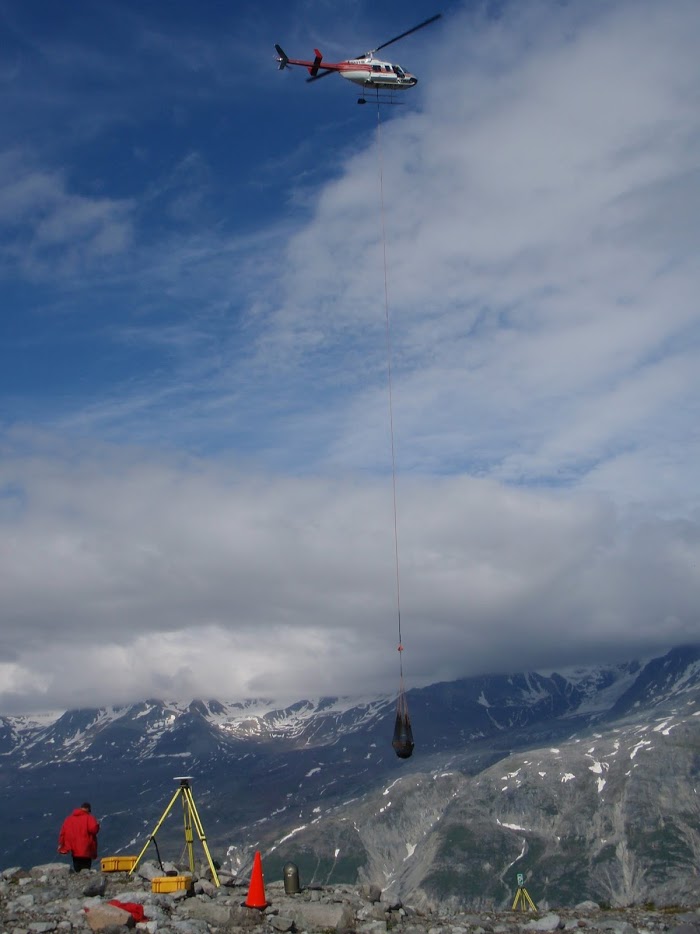
A helicopter brings in new marker materials on the Yukon–Alaska border. What a difference a century makes — in the early 1900s, markers were brought in by horseback.
Survey equipment is set up on the Yukon–Alaska border. Many markers in remote locations haven’t been visited or surveyed in over 100 years.
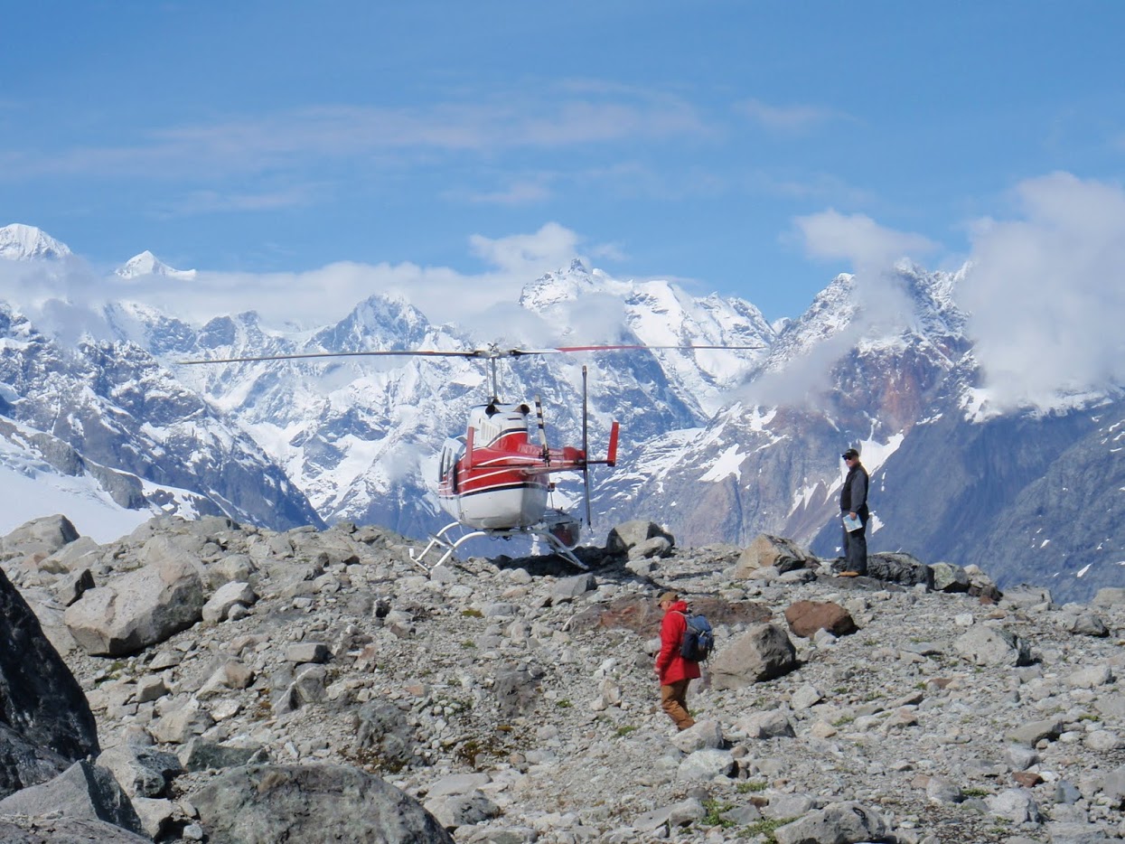
Joe and the helicopter pilot returning to the Yukon–Alaska border after searching for the boundary. The mountain peaks here form the actual boundary turning points.
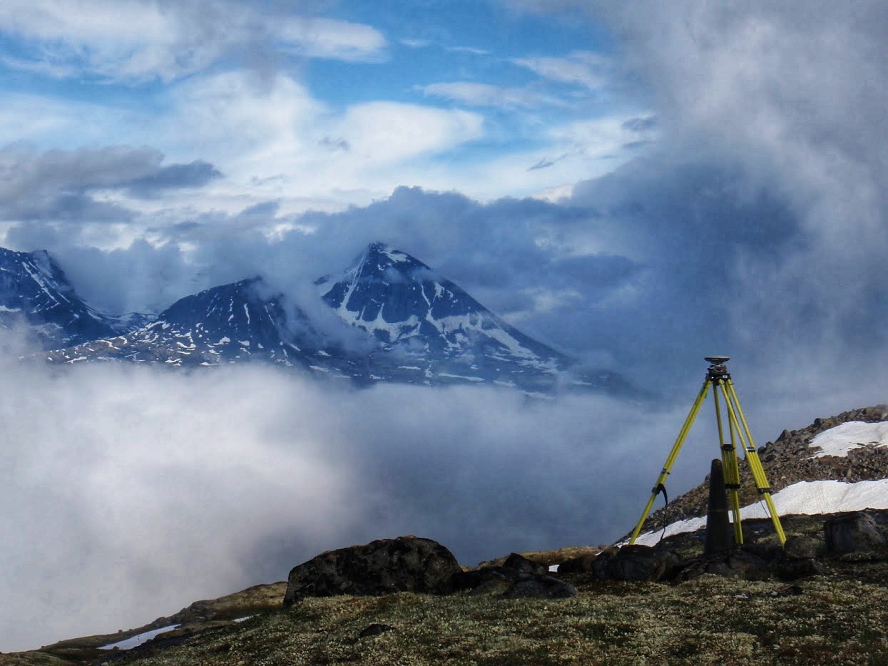
On the peak of Sturgeon Mountain along the B.C.–Alaska border, Joe surveys a site where a boundary marker was first placed more than 100 years ago.
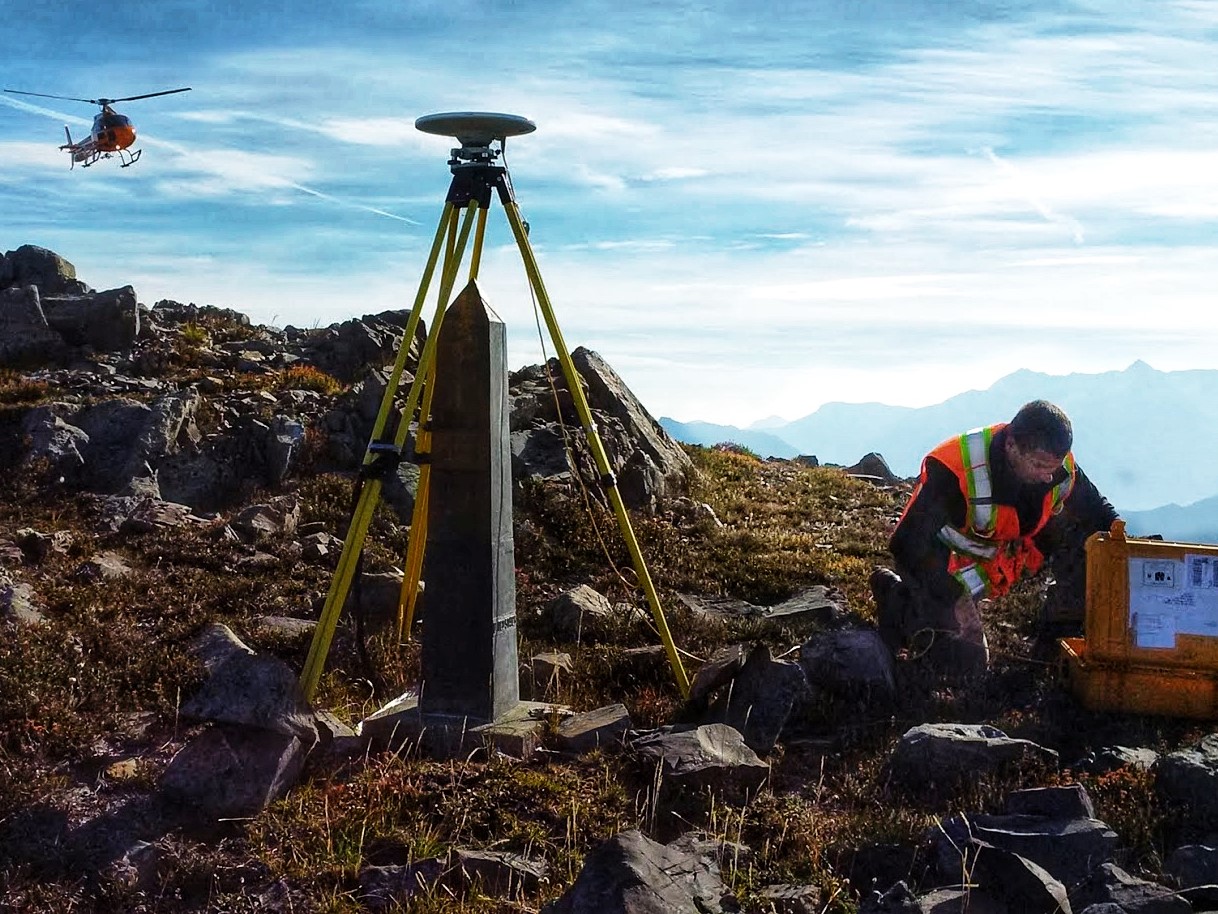
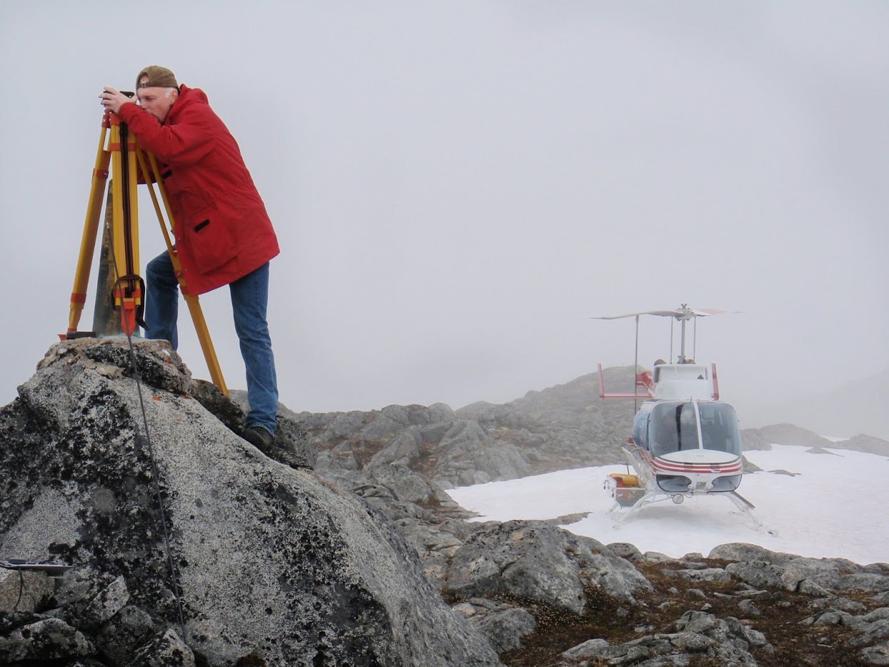
Boundary worker Karl Leblanc checks equipment during the survey through the Cascade Mountain Range at the B.C.–Washington border.
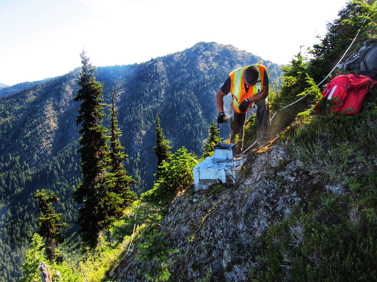
Inspecting an old marker that’s fallen down a cliff along the 49th parallel boundary, which cuts through steep mountain slopes and deep valleys along 3,500 km of terrain.
.jpg)
About every 10 years the Boundary Commission inspects the 6-metre wide straight-line cut along the border through forested areas.
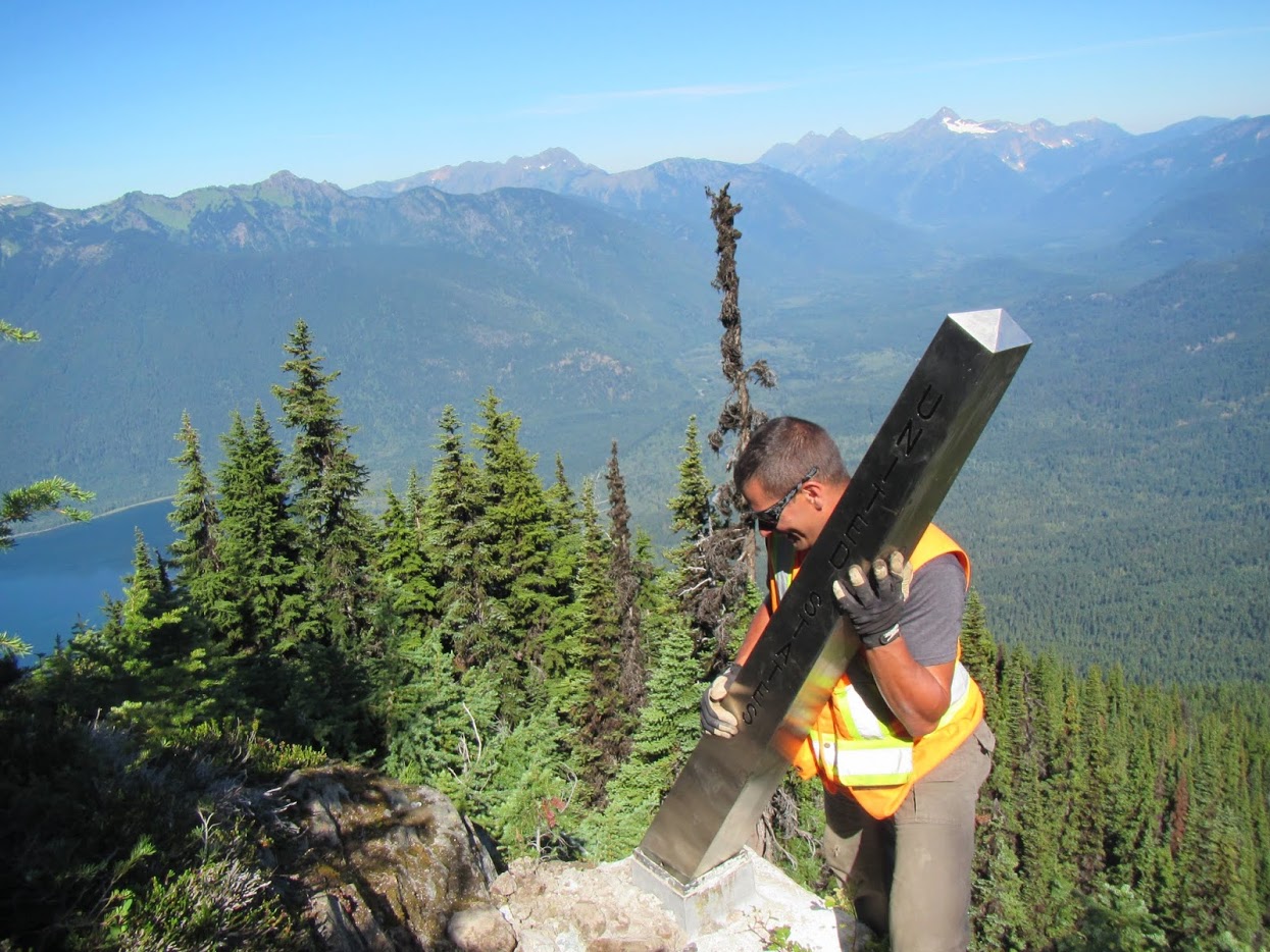
Installing a new boundary marker on the 49th parallel. Markers made of lighter stainless steel rather than the conventional granite are used in remote regions with difficult terrain.
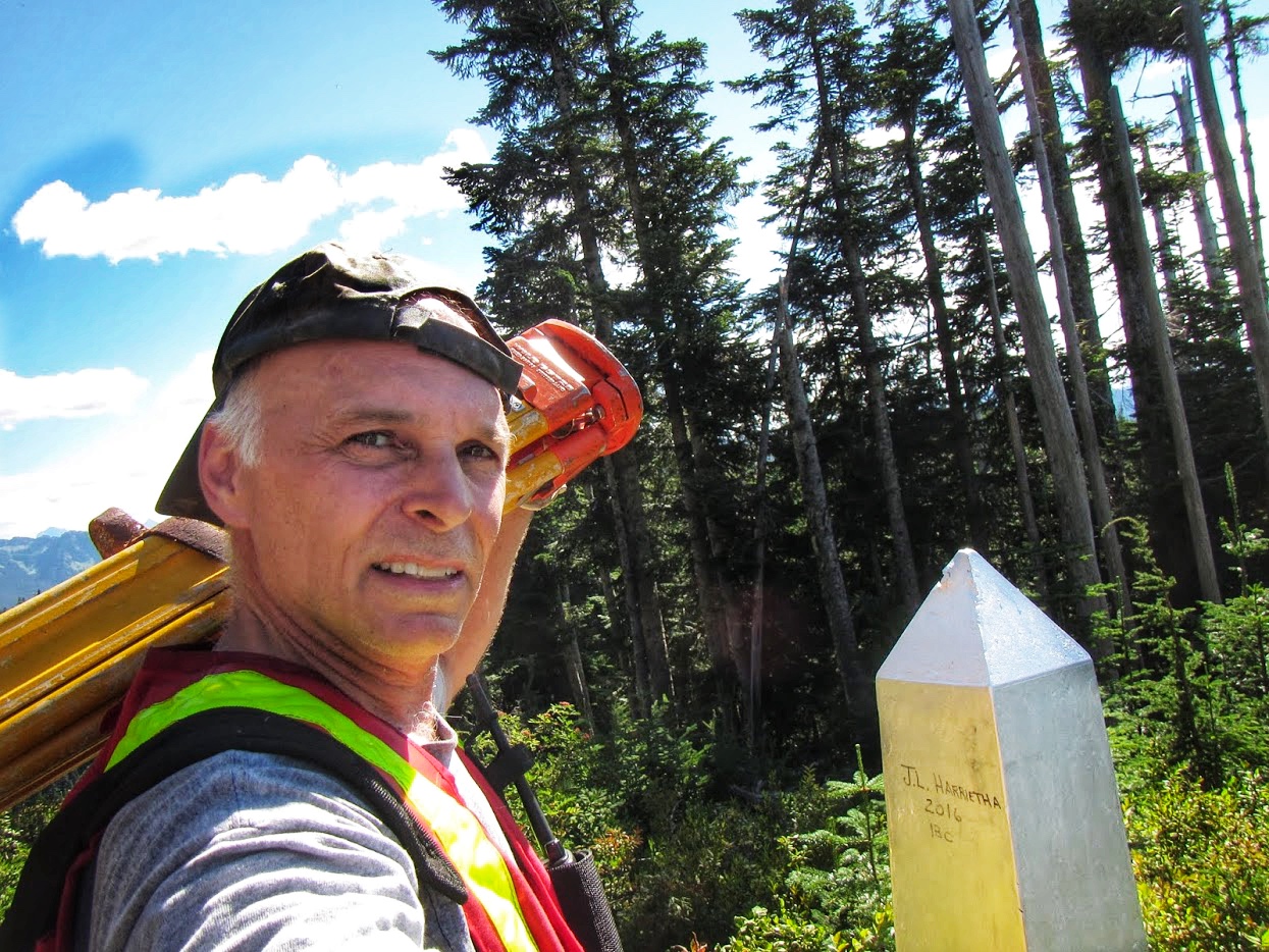
A selfie in B.C.’s Cascade Mountains. Joe signed his name on the marker for the next surveyor to find in 100 years’ time.